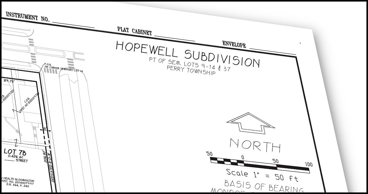
Hopewell: Name of new neighborhood to be built on former hospital site announced

When some Bloomington residents came together to engage the public process connected to the city’s rezoning effort a couple of years ago, they called themselves the Hopewell Group.
They took the moniker from the hospital that was opened about 120 years ago by the Local Council of Women at First and Rogers Streets. The brick building, which was called Hopewell House, along with four and a half acres of land, was purchased from Isaac Hopewell. The headline of the Nov. 29, 1905 edition of the Bloomington World read “Open Hospital.”
Also bearing the Hopewell name will be a new neighborhood to be built on the site of the hospital that eventually replaced Hopewell House. The city of Bloomington announced the choice of name in a news release issued Friday.
The name “Hopewell Subdivision” appears on the plat that Bloomington’s redevelopment commission (RDC) has submitted to the city’s plan commission for review at its Monday, Feb. 7 meeting.
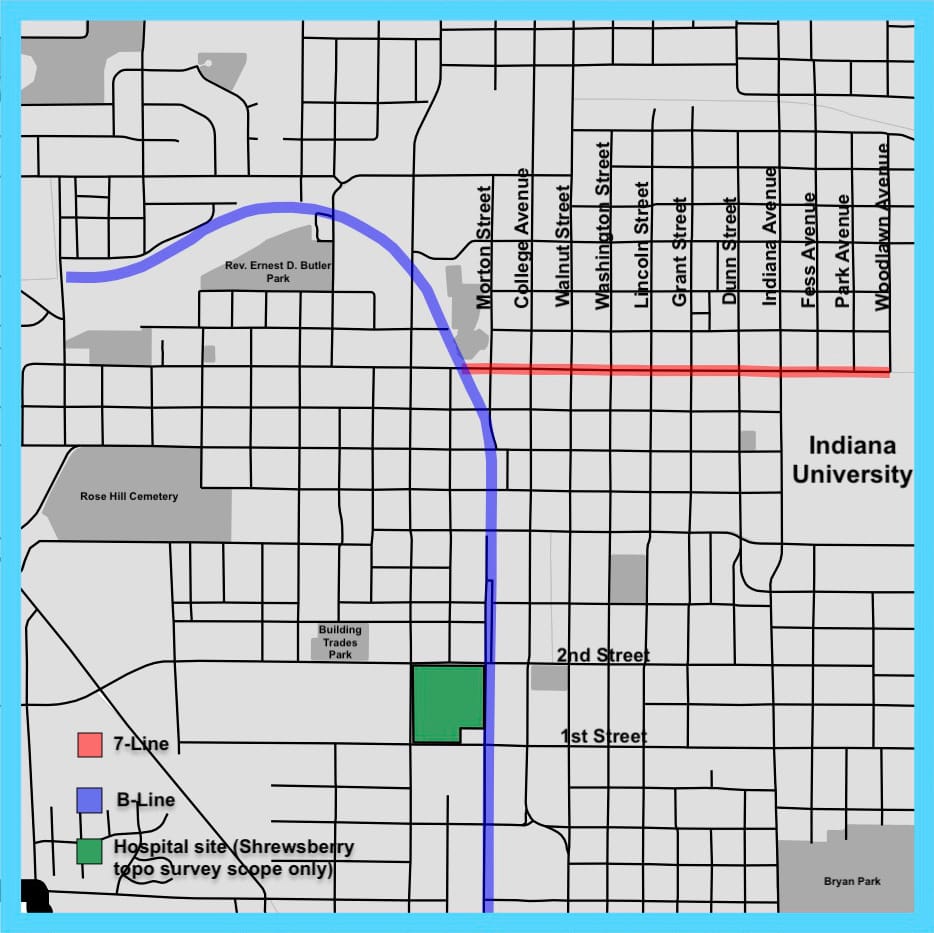
After IU Health’s early-December move from the site site last, Bloomington is taking over the site as part of a $6.5 million real estate deal that has been long in the works. Except for the parking garage and the Kohr administration building, IU Health will be demolishing the buildings on the site.
The plat for the land to be reviewed by the plan commission next week is east of the site to be demolished.
In October last year, the city of Bloomington’s redevelopment commission (RDC) hired Borshoff, a public relations firm, to develop a visual identity, branding, and a marketing plan for the site, as well as to help settle on a name for the neighborhood. The contract with Borshoff for the work was for $82,500.
All of the work by Borshoff is supposed to be completed by March 2022.
The choice of the name “Hopewell” had a lot of support among Bloomington residents.
The plat to be reviewed by Bloomington’s plan commission on Monday is not for the whole former hospital site. The land question is bounded by 1st and 2nd streets on the north and south. The boundaries to the east and west are formed by Morton and Rogers streets. A plat is a map that shows how the land is divided into lots.
The proposed plat was drafted by Shrewsberry Associates. It’s part of the design work included in the $1,048,880 design contract with the firm that the RDC approved in June of 2021.
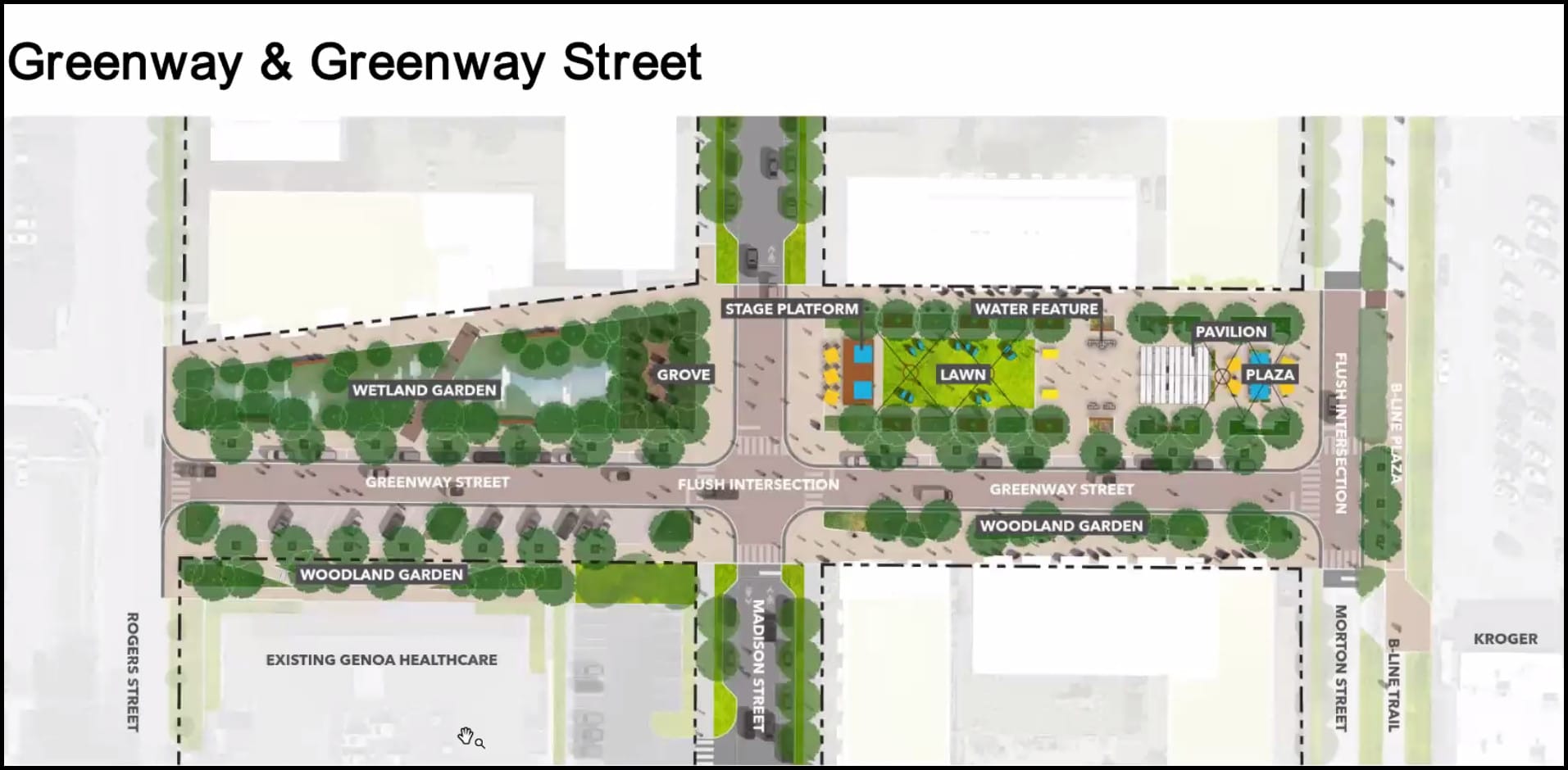
Another “new” name that appears on the schematics submitted to the plan commission is West University Street, which runs east-west, and splits the block between 1st and 2nd streets. East University Street already exists at the same latitude, starting at Lincoln Street running eastward from there.

Comments ()