Bloomington area braces for big storms on Saturday (July 19)
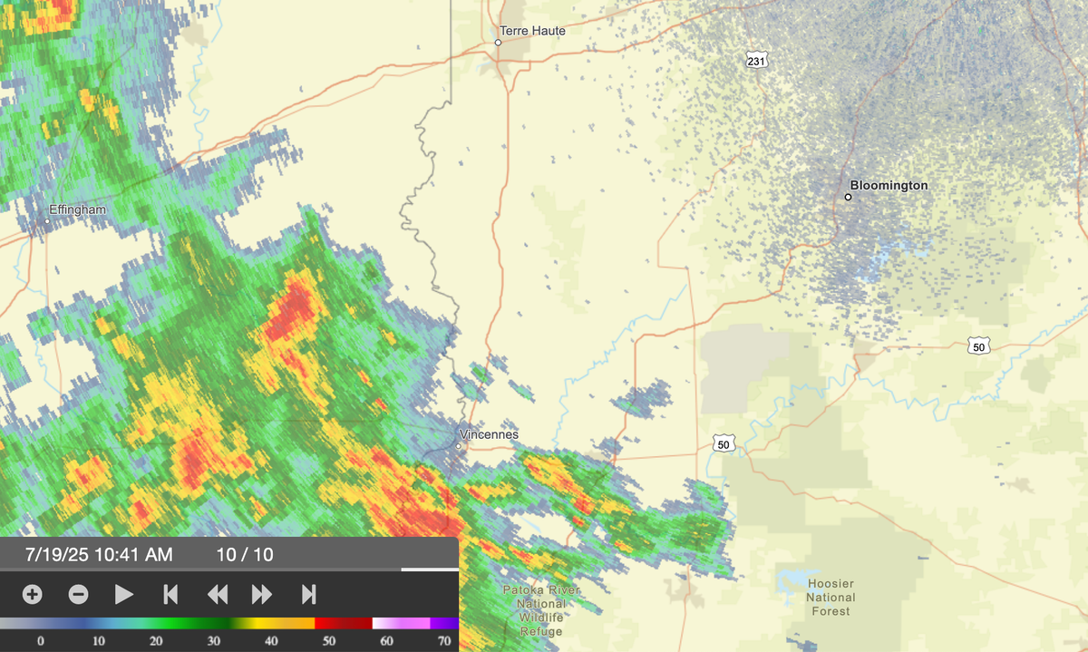
The National Weather Service has issued a hazardous weather alert that includes Monroe County and several other central Indiana counties, warning that severe storms are possible for Saturday afternoon (July 19) and the early evening hours.

The National Weather Service has issued a hazardous weather alert that includes Monroe County and several other central Indiana counties, warning that severe storms are possible for Saturday afternoon (July 19) and the early evening hours.
The threats described in the NWS alert include damaging winds as well as heavy rain and flash flooding. Through the night more thunderstorms are possible, including the possibility of heavy rain and flooding.
More thunderstorms are possible through Sunday, but according to the NWS alert, the main threat from Sunday through Tuesday will be heavy rain and flash flooding.
One measure of the possible bad weather was a news release from Duke Energy on Friday saying that the power company is ready for the weekend storms.
Duke’s release says to make sure your mobile phone is charged and that you have enough flashlights, batteries, bottled water, and nonperishable foods and medicines.
Here’s a list of links for directly monitoring short-term forecasts, advisories, watches and warnings.
- Bloomington NWS forecast. Includes the most recent hazardous weather alerts
- Bloomington NWS radar map. The map shows high-resolution radar as well as alert areas
- Lightning maps. The maps show a live plot of lightning strikes.
- Duke Energy power outage map. The map shows areas of outage with the number of customers affected.
- NWS watch map. This is the National Weather Service map of watches.
- NWS advisory map. This is the National Weather Service Map of advisories.

Comments ()