Column: Choices about Bloomington’s new common council districts should be a tale of at least two cities

Bloomington’s five-person redistricting commission is scheduled to meet for a fourth time this coming week on Wednesday, Aug. 31 at 7:30 p.m.
At the Aug. 31 meeting, it looks like the commission might be considering just one proposed map of new common council (aka city council) districts. And given the relevant deadlines, it looks like the commission could settle on that map as its recommendation to the city council.
It would be a shame if that’s the only map that the commissioners investigate in any detail, before recommending it.
The point of this column is to provide at least one additional map that commissioners might throw into the mix, before they settle on a recommendation to the city council.
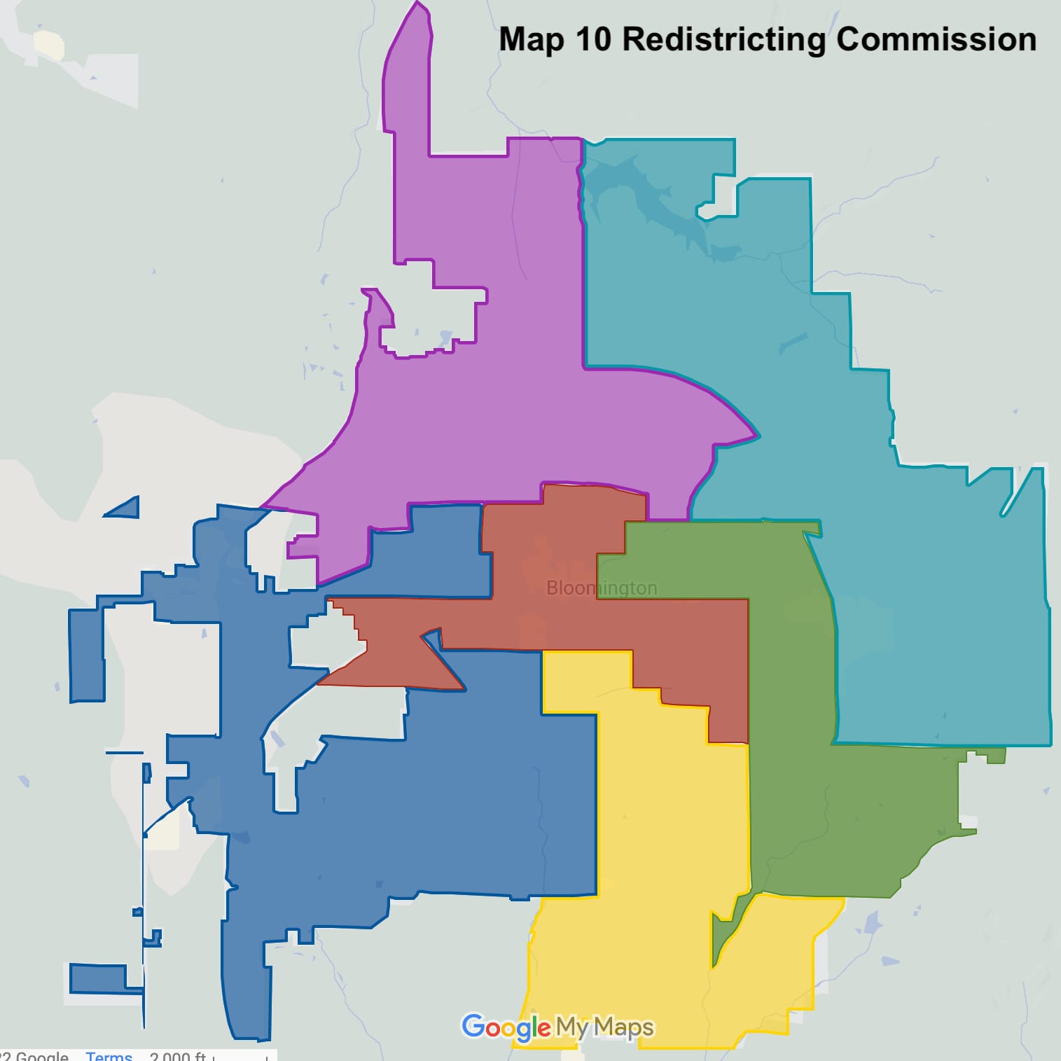
By the end of their third meeting last week, the commission had given consideration to just two different maps. That consideration could be described as light discussion. And it turns out that one of the maps does not meet a basic requirement of contiguity. Otherwise put, it is not legal.
Drawing new council district boundaries—to balance out population differences that have emerged over the previous 10 years—is a task the city council has to complete in the second year after every decennial census.
Under the city’s 2020 ordinance that established the commission, Sept. 7 is the deadline by which the commission has to recommend a new district map to the city council. The council could adopt the recommended map, or punt it back to the commission for revision. In any case, the council has to make its redistricting decision by the end of the year.
The commission’s current time crunch is not their fault. The commission was supposed to be appointed in January 2021. But the city council did not seat the commission until about 18 months later, in mid-June this year
Based on their meeting last week, redistricting commissioners were planning on Aug. 31 to dig into the differences between two different possible maps and try to settle on their recommended choice. The commission meeting that is scheduled for the morning of Sept. 7 is intended to be brief, only for the purpose of taking a final vote on the commission’s recommendation—if the meeting is held at all.
Given that one of the two maps appears to be illegal, it appears that just one map will remain for further consideration on Aug. 31.
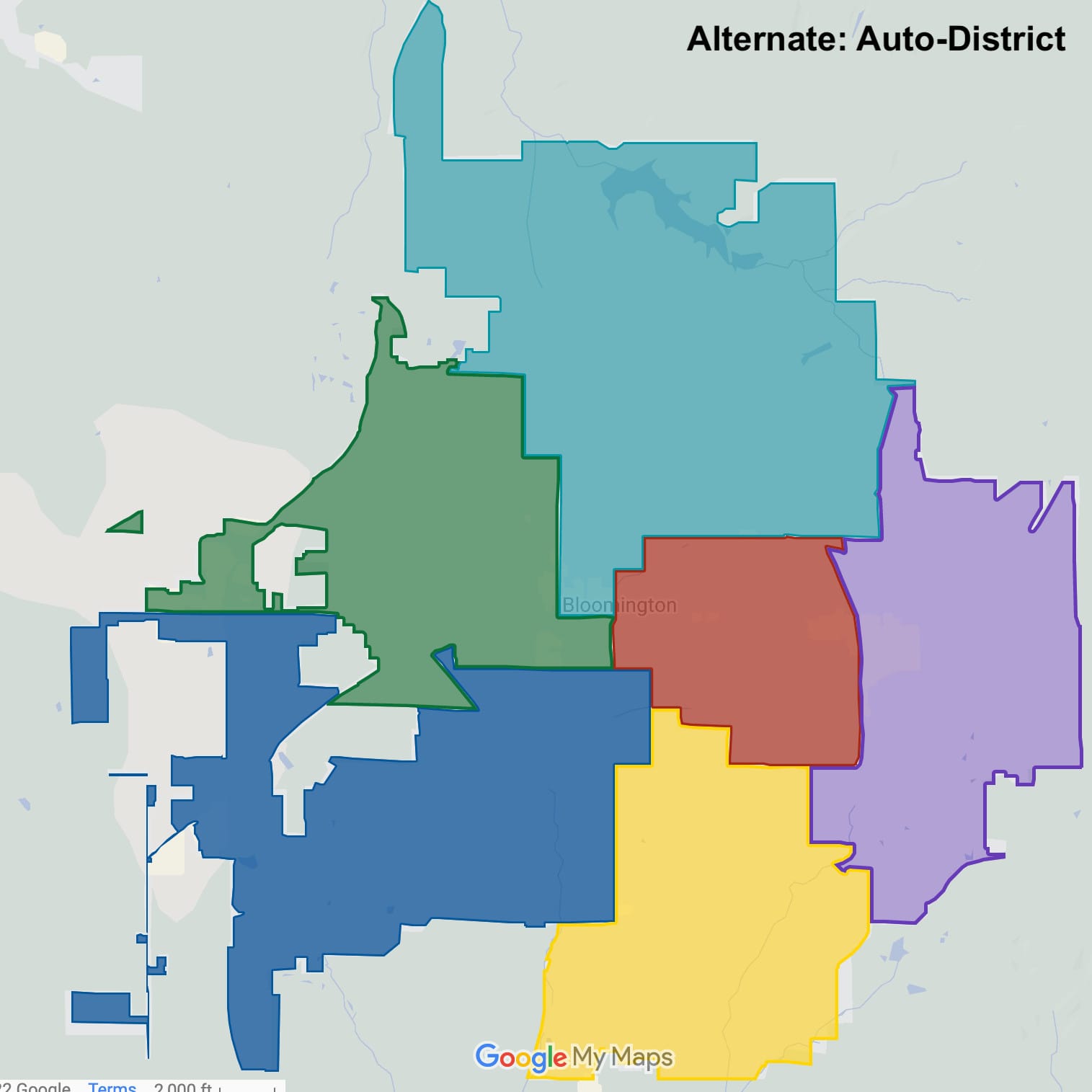
The map that proved to be illegal was submitted by The B Square. It had been generated with the aid of a software program called Auto-District, and was optimized to split townships across as few districts as possible. Only in response to some public comment at last week’s meeting did commissioners discuss the map that eventually proved to be illegal.
To prevent Auto-District from disconnecting a district based on the disconnectedness of a precinct in the district, The B Square gave Auto-District a set of revised precincts. One of the new “precincts” was built by taking the union of the disconnected precinct with the adjoining precinct inside the city. The new “precinct” was assigned the sum of the population of its constituent precincts.
The map that Auto-District settled on after crunching through 8,000 different maps, is the one that The B Square is offering for consideration by the public and the redistricting commission.
Both the commissioner-drawn map (Map 10) and the Auto-District map have less than 10 percent variation across districts. Variation is defined as the maximum minus the minimum divided by the average population of a district.
The B Square has set up separate Google Maps for each proposal, with layers for the proposed new districts, and neighborhood association boundaries, elementary school districts, and historic districts. The layers can be toggled on and off so that the impact of the two maps on those communities of interest can be inspected visually.
The B Square has also set up separate maps on the Districtr platform, which includes a layer for distribution of population by race.
- AutoDistrict Google version
- AutoDistrict Districtr version
- Map 10 Commissioner Google version
- Map 10 Commissioner Districtr version
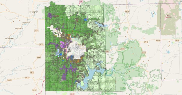
For all the redistricting information that the city’s GIS staff has compiled, see the city’s ESRI-based redistricting web page.

Comments ()