Monroe County Public Library a source of map collections showing Bloomington’s past annexations
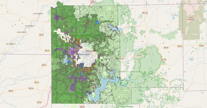
In 2017, Bloomington began the process of annexing area into the city that would have increased the land area of the city by about 60 percent.

Later that year, the state’s General Assembly built into the budget bill a change to annexation law that effectively singled out Bloomington and paused any annexation plans for five years.
Bloomington filed a lawsuit, contending that the General Assembly violated two different parts of the state’s constitution: One limiting bills to single topics and another prohibiting special legislation.
On Tuesday, March 26, the two sides will be giving oral arguments in front of Judge Frank M. Nardi to complement the written arguments and counterarguments they’ve already submitted to the court.
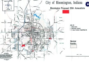
One of the points of history recited in court papers filed by the city is the fact that Bloomington has not annexed multiple parcels into the city for a decade and a half. From the city’s memorandum in support of its motion for summary judgment: “In February of 2017, the City of Bloomington initiated its first multi-parcel annexation proposal since 2004.”
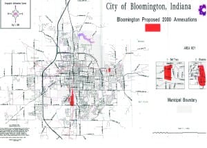
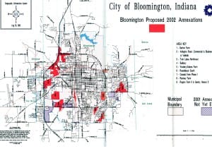
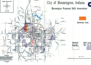
What did Bloomington’s proposed annexations look like 15 years ago? What about in the years before that?
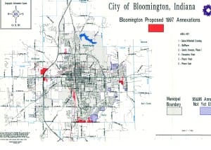
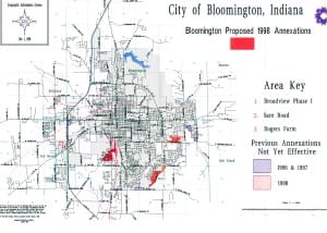
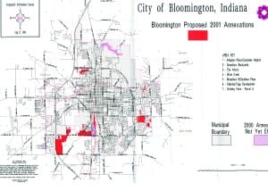
At least part of the answer can be be found on the shelves of the Indiana Room in the Monroe County Public Library. Three-ring binders with materials related to Bloomington’s proposed annexations are available for 1997, 1998, 2000, 2001, 2002, 2003 and 2004. The binders include letters sent to affected property owners and detailed descriptions of the areas.
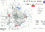
The binders also include maps. The map pages can be removed from the binders for easy scanning into a digital format. A large format flatbed scanner is available to library patrons at no additional cost. The interface allows patrons to save images to a USB drive or send the images to themselves as an emailed attachment.
That’s where the individual images for this animation come from. (Scroll down for static higher resolution images for each map.)


Comments ()