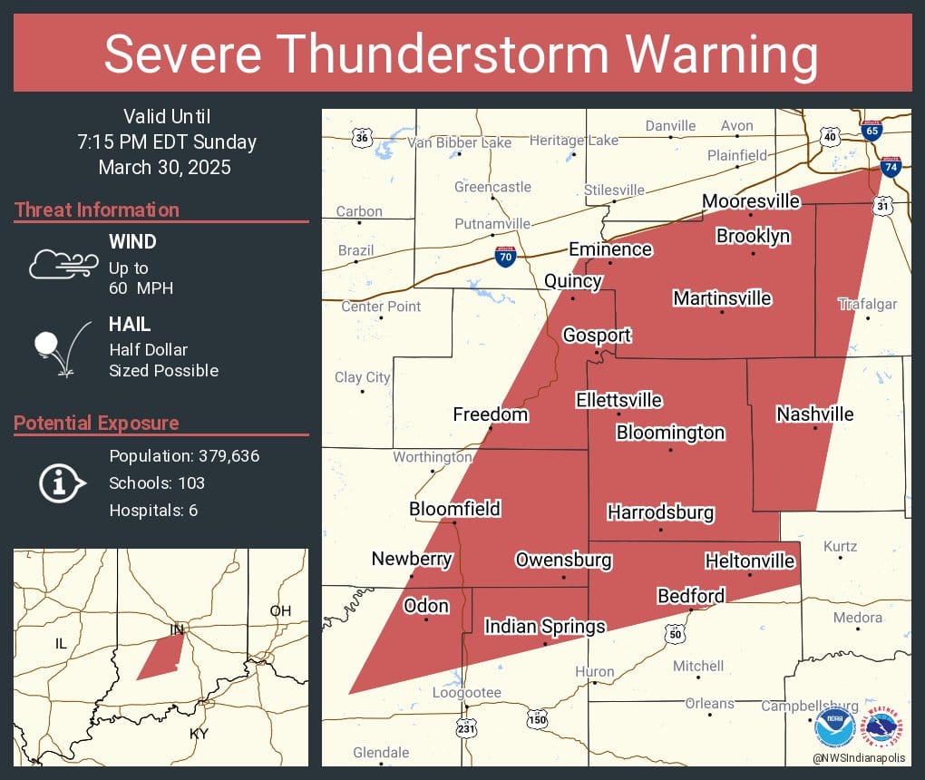
Monroe County: NWS warns of severe thunderstorms, hail, 60 mph winds until 7:15 p.m. March 30, 2025
7:14 p.m. Around 3,000 Duke Energy customers are now without power in the Ellettsville and Bloomington area.
7:01 p.m. Around 1,000 Duke Energy customers are without power in the Ellettsville and Bloomington area.
6:47 p.m. Based on Monroe County alert system, NWS issues a tornado warning for southeastern Monroe County until 7:15 p.m. Sirens sound briefly in downtown Bloomington.
6:47 p.m. High winds hit downtown Bloomington. The B Square's bedroom window is blown out of frame into apartment—duct-taped back into place.
6:36 p.m Monroe County's emergency alert system sends texts and emails about the severe thunderstorm warning.
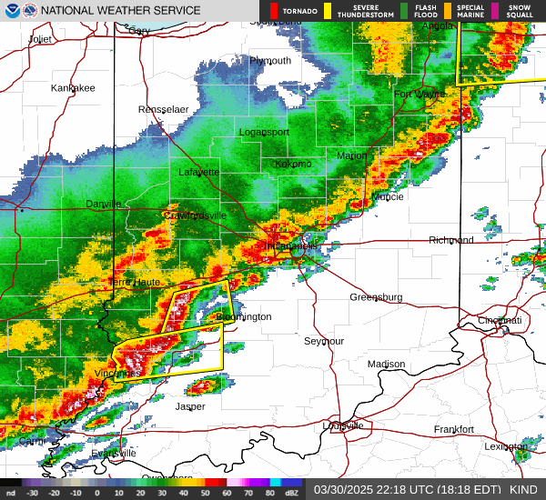
Around 6:30 p.m. on Sunday evening (March 30), the National Weather Service issued a severe thunderstorm warning for parts of south central Indiana, including all of Monroe County.
The warning includes possible half-dollar sized hail, and winds up to 60 mph, and is effective through 7:15 p.m.


Comments ()