Starting late afternoon April 2: All hazards possible, according to NWS—floods, thunderstorms, hail, tornadoes

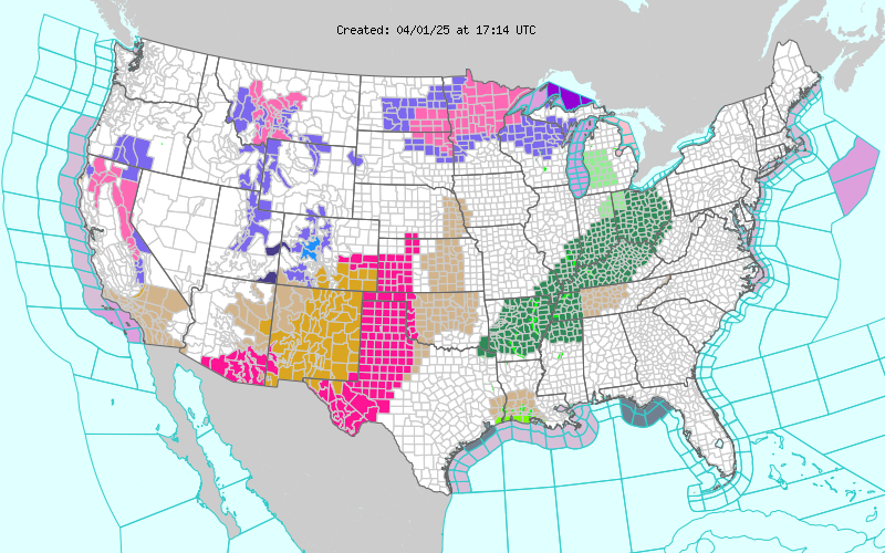
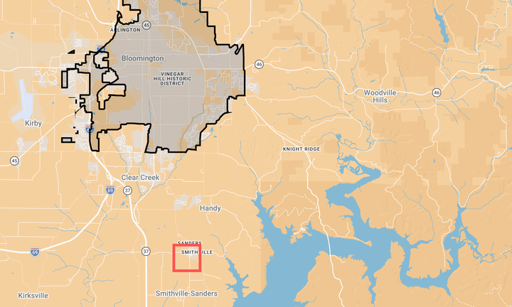
A flood watch has been issued by the National Weather Service for a big swath of the Midwest, including Bloomington, Indiana, starting Wednesday evening (April 2) and lasting through Sunday morning (April 6).
The impact of the system could be felt early Wednesday afternoon, before any storms hit, as wind gusts of up to 45 mph are predicted.
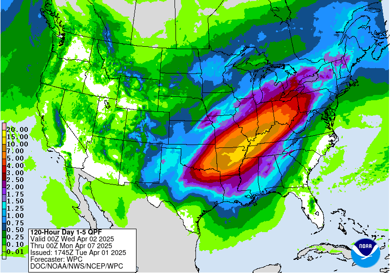
Based on the NWS Weather Prediction Center forecast totals, Bloomington could get up to 7 inches of rain over the five days from Wednesday night to Monday morning. As much as 5 inches of that total could come in the first two days.
It’s not just heavy rains that are forecast. Greg Melo, a meteorologist with the National Weather Service working out of the Indianapolis office, told The B Square: “All hazards are on the table.”
That means thunderstorms, hail, high winds, and tornadoes. Melo pointed out the 45-mph gusts that are possible, independent of the thunderstorms that are expected to move through.
As of early afternoon on Tuesday, April 1, the system that will produce the deluge was not readily discernible on a national radar map—it was still located over the Rockies. But around Wednesday morning, it will be possible to pick out the system on the map, as it starts to deepen and strengthen over the plains, Melo said. The system will intensify “rather quickly” as it moves northeastward towards the upper Midwest, and it will be apparent on the radar map, Melo said.
Monroe County’s emergency manager Jamie Neibel responded to an emailed question from The B Square by indicating that she has sent an alert to her email list of school officials, law enforcement, fire departments, people administering programs for the unhoused, and some elected officials. The alert reminds those on the list to advise those living in mobile or temporary structures located near even small streams to stay vigilant, and have a plan to get on higher ground, Neibel wrote.
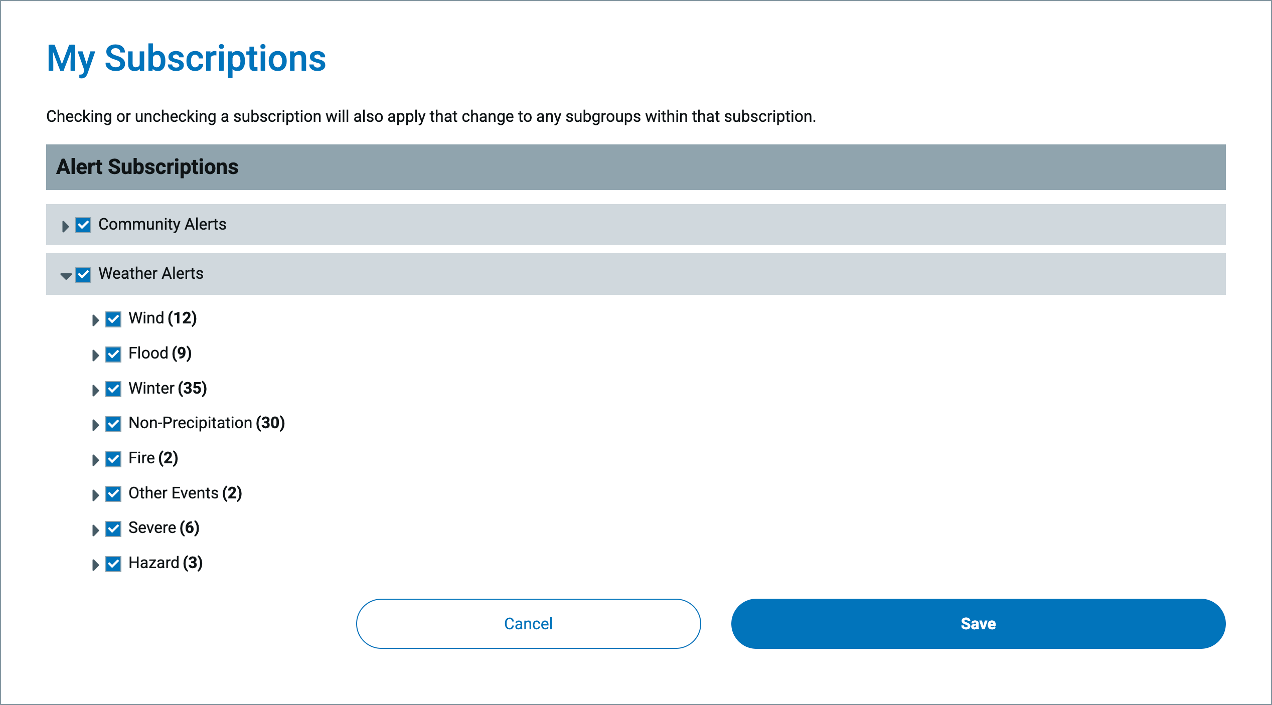
Neibel also pointed out that Monroe County’s emergency alert system, for which anyone can sign up, has an option to receive alerts for flooding events. Road closures will be posted to the Monroe County EMA Facebook page, Neibel wrote.
A spokesperson for Duke Energy wrote in response to an emailed question from The B Square that the power company is preparing for Wednesday’s storm like it does for other forecasted severe weather: There’s a team dedicated to emergency preparedness with an incident command structure.
Duke customers who lose power can report it like this:
- Visit duke-energy.com/outages on a desktop computer or mobile device.
- Use the Duke Energy mobile app. Download the Duke Energy App from a smartphone via Apple Store or Google Play.
- Text OUT to 57801 (standard text and data charges may apply).
- Call the automated outage-reporting system at 800.POWERON (800.769.3766).
Melo told The B Square that NWS is not using wording like “historic” to describe the forecasted storm that will hit Wednesday and drop rain possibly through Sunday.
Based on numbers retrieved by The B Square through the Applied Climate Information System (ACIS), National Oceanic and Atmospheric Administration (NOAA), the forecasted 7-inch totals for Bloomington over the course of 5 days would rank in the top 20 but not in the top 10 of the 5-day totals since records exist, which date to 1895.
Other images, tables


Rainfall totals in historical context
The table below was built from data accessed by The B Square through the Applied Climate Information System (ACIS), National Oceanic and Atmospheric Administration (NOAA).
| Rank | Inches of Rain | Dates |
| 1 | 9.2 | 1913-03-23 through 1913-03-27 |
| 2 | 9.09 | 1913-03-24 through 1913-03-28 |
| 3 | 8.96 | 1913-03-21 through 1913-03-25 |
| 4 | 8.8 | 1910-10-04 through 1910-10-08 |
| 4 | 8.8 | 1910-10-03 through 1910-10-07 |
| 6 | 8.72 | 1910-10-02 through 1910-10-06 |
| 7 | 8.58 | 1913-03-22 through 1913-03-26 |
| 8 | 8.3 | 1913-03-25 through 1913-03-29 |
| 9 | 8.2 | 1961-05-05 through 1961-05-09 |
| 10 | 8.1 | 1910-10-05 through 1910-10-09 |
| 11 | 7.58 | 1961-05-04 through 1961-05-08 |
| 12 | 7.25 | 1961-05-06 through 1961-05-10 |
| 13 | 7.23 | 1897-03-04 through 1897-03-08 |
| 14 | 7.14 | 2006-03-09 through 2006-03-13 |
| 15 | 6.89 | 1993-11-13 through 1993-11-17 |
| 16 | 6.71 | 2006-03-08 through 2006-03-12 |
| 17 | 6.62 | 1897-03-01 through 1897-03-05 |
| 18 | 6.48 | 1945-09-25 through 1945-09-29 |
| 19 | 6.39 | 2005-01-02 through 2005-01-06 |
| 20 | 6.38 | 2005-01-03 through 2005-01-07 |
| 21 | 6.37 | 1962-07-12 through 1962-07-16 |
| 22 | 6.32 | 1962-07-14 through 1962-07-18 |
| 22 | 6.32 | 1962-07-13 through 1962-07-17 |
| 24 | 6.31 | 1908-05-04 through 1908-05-08 |
| 25 | 6.23 | 1979-07-13 through 1979-07-17 |
| 25 | 6.23 | 1979-07-12 through 1979-07-16 |
| 25 | 6.23 | 1979-07-11 through 1979-07-15 |
| 28 | 6.1 | 2021-06-19 through 2021-06-23 |
| 28 | 6.1 | 2021-06-18 through 2021-06-22 |
| 28 | 6.1 | 2021-06-17 through 2021-06-21 |
| 28 | 6.1 | 2021-06-16 through 2021-06-20 |
| 32 | 6.09 | 1897-03-02 through 1897-03-06 |
| 33 | 6.04 | 1979-07-10 through 1979-07-14 |
| 33 | 6.04 | 2008-06-04 through 2008-06-08 |
| 35 | 6.01 | 1949-08-15 through 1949-08-19 |
| 35 | 6.01 | 1949-08-14 through 1949-08-18 |
| 37 | 5.99 | 1949-08-13 through 1949-08-17 |
| 38 | 5.91 | 1993-11-14 through 1993-11-18 |
| 39 | 5.9 | 1910-07-16 through 1910-07-20 |
| 39 | 5.9 | 1910-07-15 through 1910-07-19 |
| 39 | 5.9 | 1910-07-14 through 1910-07-18 |
| 42 | 5.89 | 1897-03-03 through 1897-03-07 |
| 43 | 5.88 | 1979-07-09 through 1979-07-13 |
| 44 | 5.8 | 1993-08-13 through 1993-08-17 |
| 45 | 5.73 | 1995-08-06 through 1995-08-10 |


Comments ()