Tornado watch, T-storm warnings Friday night in Bloomington, Monroe County
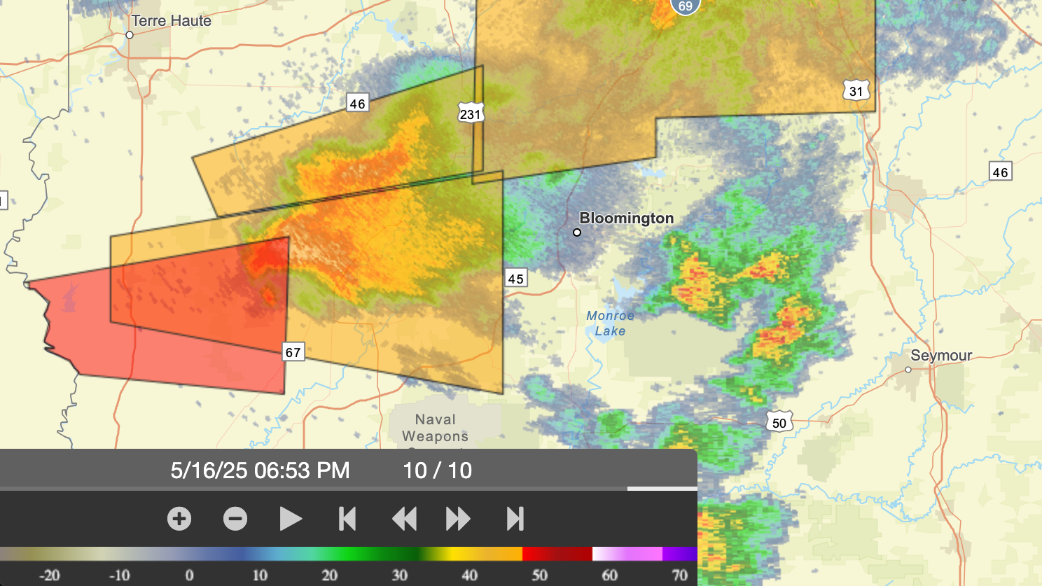
Just before 6 p.m. the National Weather Service issued a tornado watch for Monroe County and several other counties in the path of a severe weather system approaching from the west.
NWS radar confirmed the system approaching, and scanner traffic around 7:10 p.m. indicated wires down and other damage to buildings at locations in Greene County.
8:54 p.m. The final update has now been filed for this item.
8:45 p.m. Reports of houses leveled in Brown County.
8:43 p.m. Direction given for use of drone to assess damage.
8:39 p.m. Reports of injuries at state park, presumably McCormick Creek State Park.
8:33 p.m. Owen County is now getting tornado warning for this next round.
8:27 p.m. Radar shows a fresh round of storms headed it. Looks like they'll pass north of Bloomington, but give Ellettsville and Spencer a glancing blow.
8:26 p.m. Duke Energy outage map shows about 1,500 customers in the south part of Bloomington without power.
8:22 p.m. Lots of automobile traffic headed north on Walnut Street Pike. Question about whether they will be able to get through.
8:19 p.m. Sounds like IUPD units have been directed to S. Rogers Street.
8:12 p.m. Residents at the "old Ranchero Motel" are all accounted for.
8:12 p.m. IUPD reports units available for service: "Where do you want them?"
8:08 p.m. Path blocked due to trees for fire engine heading to Clear Creek post office.
8:07 p.m. At Victor Pike & That Road there's a tree down with power lines.
8:06 p.m. Scanner traffic indicates a lot of activity assessing damage, checking door-to-door to see if people are OK. Managing vehicle traffic because of lots of trees down.
7:59 p.m. "Looks like the worst of the storm has passed." NWS radar confirms that's probably right at least for the next little while.
7:56 p.m. Reports of a building flattened. No word on possibility of occupants.
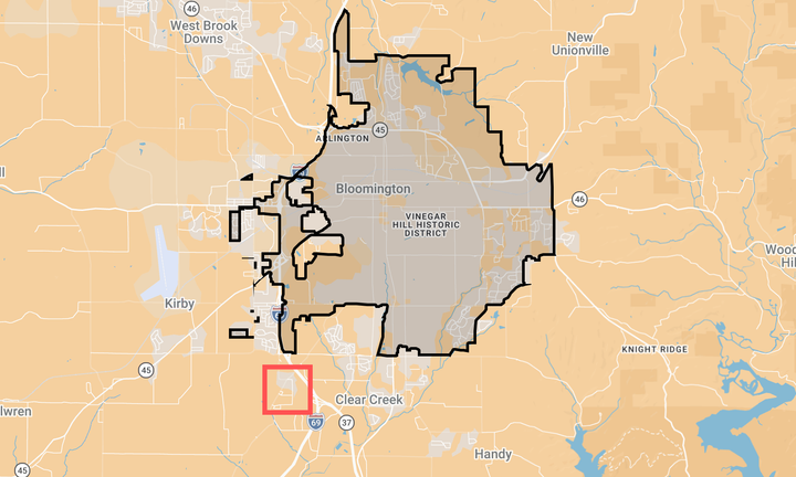
7:53 p.m. Scanner traffic indicates the path of a tornado tore a swath across south of Bloomington in vicinity of That Road.
7:52 p.m. Video shot by David Martin, taken from 5776 W. Monarch in Bloomington
7:48 p.m. Tornado warning now issued for east central Monroe County through 8:15 p.m.
7:43 p.m. Sun is out in downtown Bloomington.
7:37 p.m. Tornado warnings issued for Brown County and Bartholomew County.
7:36 p.m. Possible citizen report of tornados near Kroger South and Kirkwood & Adams (?)
7:43 p.m. Heavy rain pelting downtown Bloomington. Lights flickering, but power is still on.
7:33 p.m. Rotation reported starting near trailer park off Gordon Pike.
7:31 p.m. Report of second tornado touched down on Leonard Springs Road west of Bloomington.
7:30 p.m. Sirens continuing in downtown Bloomington.
7:29 p.m. Scanner traffic reports tornado on the ground southwest of Monroe County airport, headed towards Bloomington.
7:26 p.m. Report that audience at Buskirk-Chumley Cosmic Songwriter Festival has been sent to basement.
7:24 p.m. Tornado warning issued again for southern Monroe County until 7:45 p.m.
7:18 p.m. Tornado warning issued for Monroe County. Scanner traffic indicates a report of people trapped in a house that was struck by tornado. Location is Worthington. Sirens heard in downtown Bloomington.
7:15 p.m. Severe thunderstorm warning issued for Monroe County with baseball sized hail.


Comments ()