Traffic notebook: 20 is plenty for some Bloomington streets, but not that many
In June, the city of Bloomington issued a news release announcing that Bloomington had been given a Gold-level Bicycle Friendly Community (BFC) award by the League of American Bicyclists (LAB).
That was not a big surprise, because Bloomington has previously received a Gold BFC award from the LAB—in 2014 and 2019.
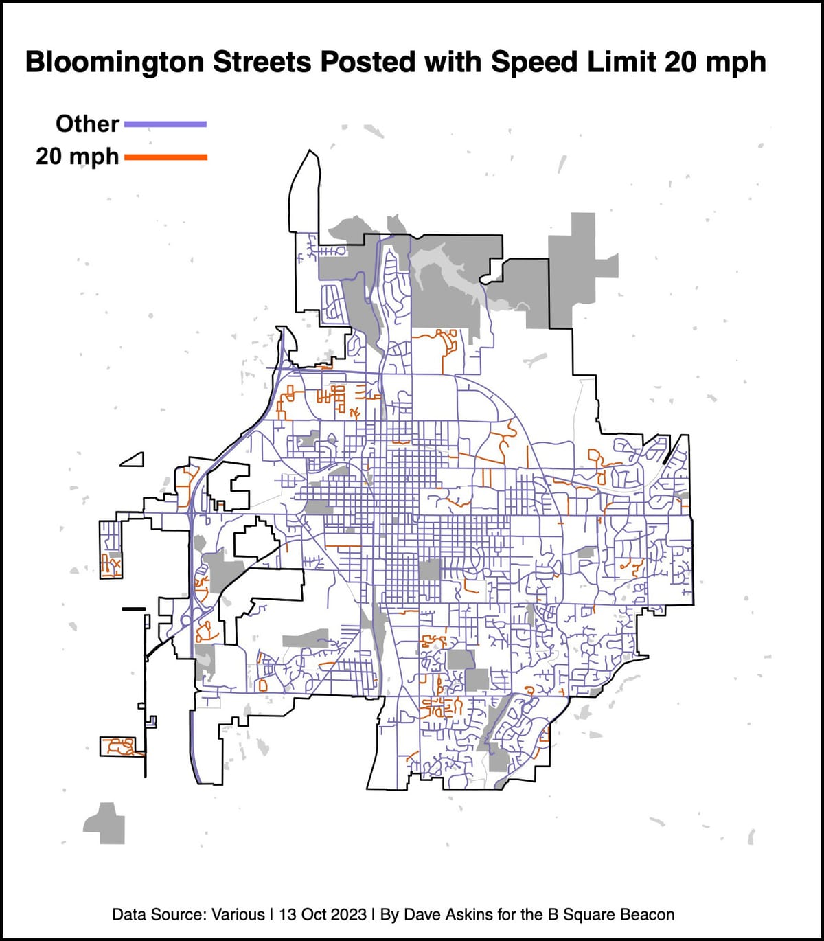
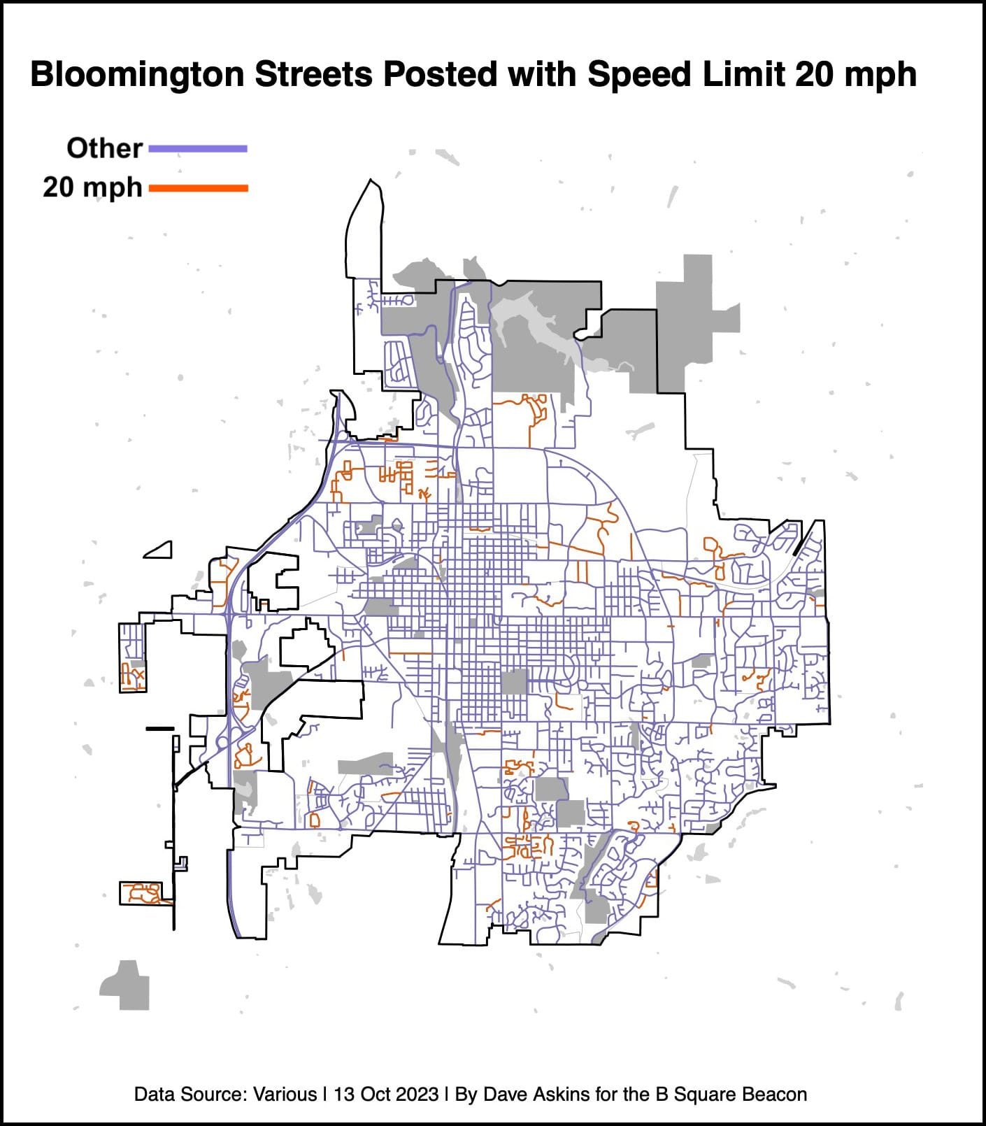
But an alert B Square reader noted an odd statistic about Bloomington that was included in the LAB’s own description of its awards this year: “In their application, Bloomington indicated 54 percent of their roads have a signed speed limit of 20 mph or less.”
Long story short, that percentage is not accurate—it’s probably closer to 8 percent. But that mistake did not have an impact on the award, according to LAB.
Amelia Neptune, who is director of the LAB Bicycle Friendly America Program. Neptune wrote in response to a B Square question, “This % alone would not have changed [Bloomington’s] Gold ranking.”
Neptune added, “In fact, they [Bloomington] became a Gold BFC in 2014, and renewed again in 2018—and both of those awards were granted before we added the question about 20-mph roads.”
That’s consistent with the 20-mph percentages for some other communities that received Gold awards in the most recent BFC round. Based on numbers provided to the B Square by LAB, 20-mph road percentages for Gold awards in the most recent round ranged from 0-9 percent for five cities. Bloomington was part of a cluster of four cities with percentages between 53 and 69 percent.
Bloomington’s bicycle and pedestrian coordinator, Hank Duncan, is relatively new on the job—he started just about a year ago, in October 2022. Duncan told The B Square he is not certain how the numbers were derived that were used to calculate the 54 percent that is included in the Bloomington’s BFC application. He relied on information from his predecessor, Duncan said.
Duncan said he had not been aware of the dataset available through the Monroe County’s GIS system, which shows the percentage of roads posted at 20 mph or slower at around 8 percent.
When the city applies to the LAB four years from now for an award in the BFC program, the number from the GIS dataset will be used, Duncan said. (One caveat: The B Square has identified some apparent discrepancies between the street-by-street list of 20-mph streets listed in city code, and the 20-mph streets in the GIS dataset.)
About Bloomington’s prospects for achieving the Platinum level, which is the next higher one above Gold, Duncan said, “I genuinely do think that we have a long way to go before we get to the Platinum level. ”
For any frequent user of Bloomington’s streets, 54 percent is probably a surprising number for the fraction of streets that are posted at 20 mph or slower. It’s probably even more surprising to folks who know something about how speed limits are set for streets in Hoosier cities.
Under state law, cities can set their own speed limits for streets inside their boundaries, but not lower than 25 mph, unless certain criteria are met. Bloomington has set the default speed limit for city streets at the minimum that’s allowed under state law—25 mph.
To set a speed limit lower than 25 mph, a city has to conduct an “engineering and traffic investigation.”
That’s a part of the legal landscape that Bloomington city engineer Andrew Cibor has cited, when asked why Bloomington does not simply post the 7th Street corridor with a 20-mph speed limit—if the goal is to reduce speeds along that stretch, and thereby reduce crashes.
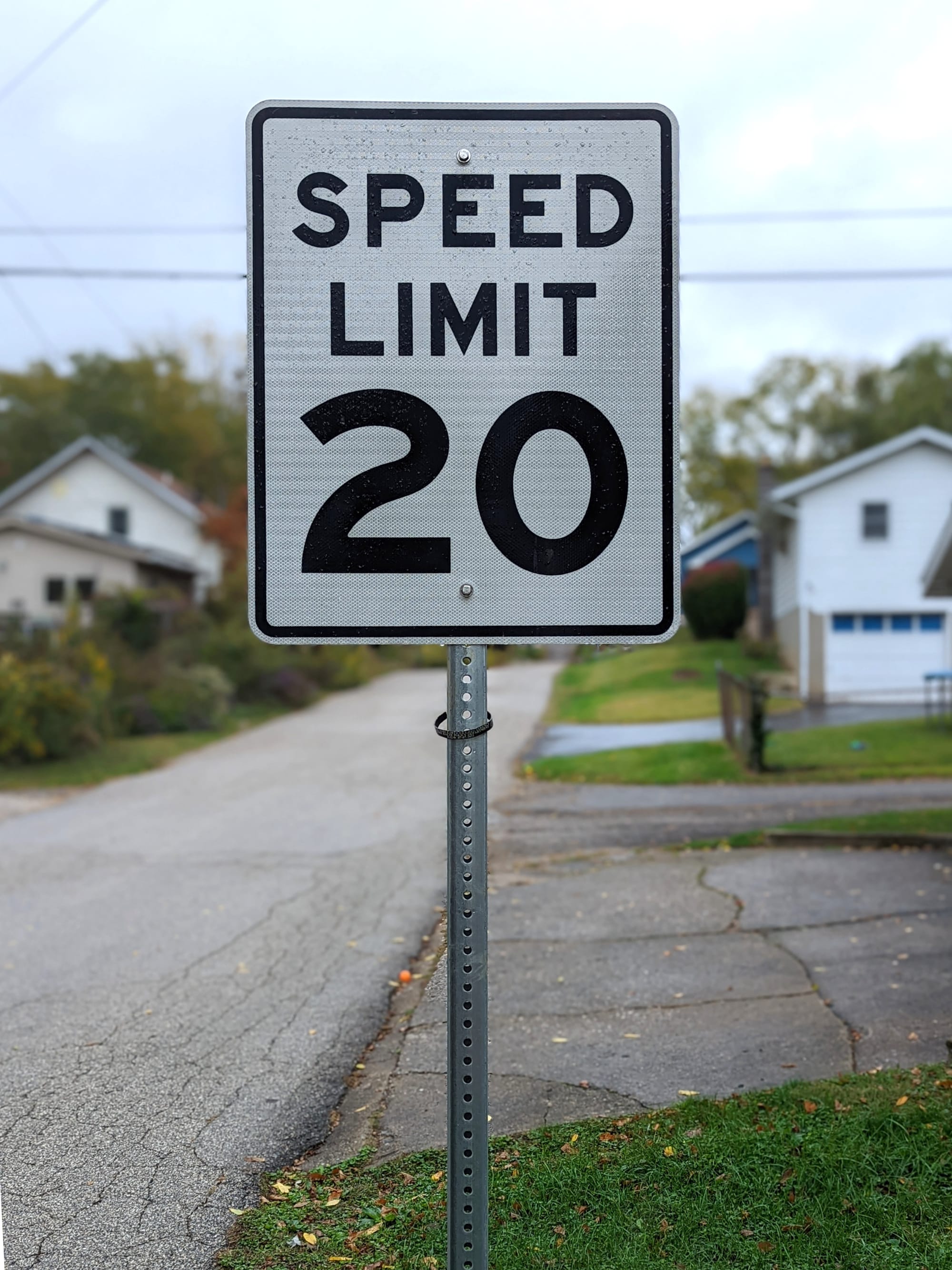
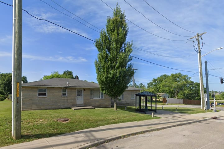
The B Square’s effort to collect “art” for this piece—a photograph of a 20-mph speed limit sign—revealed that even the GIS dataset of streets does not appear to be perfectly accurate for all the 20-mph streets.
For example, the GIS dataset shows Law Lane as posted at 20 mph. On inspection, it’s not posted like that, and Law Lane is not included in the city code’s table of streets with speed limits that are different from 25 mph.
As another example, the GIS dataset does not include Wilson Street, east off Walnut Street, as a street that is posted with a 20-mph speed limit. But in real life, Wilson Street is posted with 20-mph speed limit signs, and it is listed in the city code table of 20-mph streets.
That’s why there’s a photograph of Wilson Street, not Law Lane, included with this article.

Comments ()