Plat near former hospital OK’d by Bloomington plan commission, city council must approve alley vacation

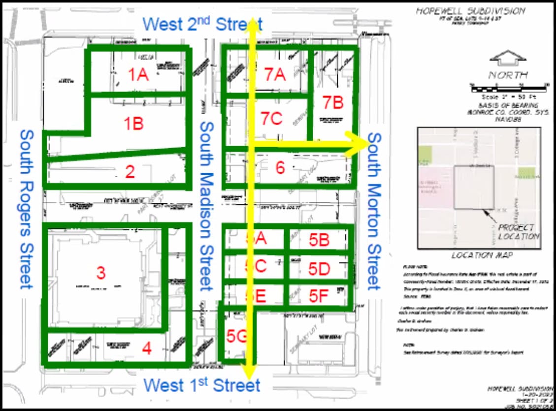
Getting unanimous approval from Bloomington’s plan commission on Monday night was a new plat for most of the area bounded by 1st and 2nd streets on the north and south, and Morton and Rogers streets on the east and west.
A plat is a map that shows how the land is divided into lots.
The block is next to the former IU Health hospital site that is being transferred to the city of Bloomington in a $6.5-million real estate deal. It will be redeveloped as a part of that project, which is known as Phase 1 East in the project master plan. Last week, the city of Bloomington announced that the future development planned there will be called the Hopewell neighborhood.
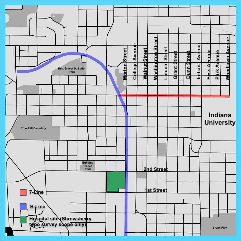
As part of the plat, Madison Street will be extended south from its current intersection with 2nd Street to 1st Street, and a new “greenway street” called West University Street will be built between Rogers and Morton Streets.
The next step for this particular block will be for the city council to approve the vacation of two alleyways. The alleys won’t be needed in those locations, given the construction of two new streets. (The alleys that need city council approval to be vacated are shown with yellow arrows in the image included with this article.)
The plat request was put forward by the Bloomington redevelopment commission, which is organ of the city that is paying for the real estate transaction as well as the site preparation and design.
The plat approval was not controversial for plan commissioners, two of whom were attending their first meeting as plan commissioners: Tim Ballard and city councilmember Ron Smith.
But plan commissioners asked staff to respond to some questions raised during the public comment period by Eoban Binder, who lives near the site. (Binder is also a member of Bloomington’s parking commission, but was speaking as a Prospect Hill resident, not on behalf of the parking commission.)
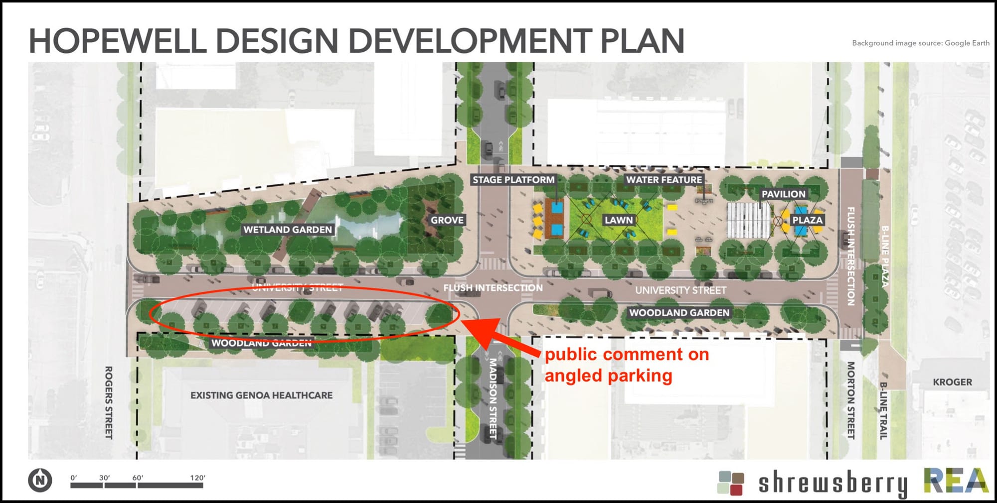
Binder questioned the need for angle parking along the south side of the new east-west “greenway” street, which is to be called West University Street. The on-street parking is intended to be “reverse angle,” which means that motorists will back into the spaces. It’s an approach that, among other things, is supposed to help prevent kids from spilling out of cars into traffic—because the car doors opened on a reverse-angle parked car shunt passengers most naturally in the direction of the sidewalk, not into the street.
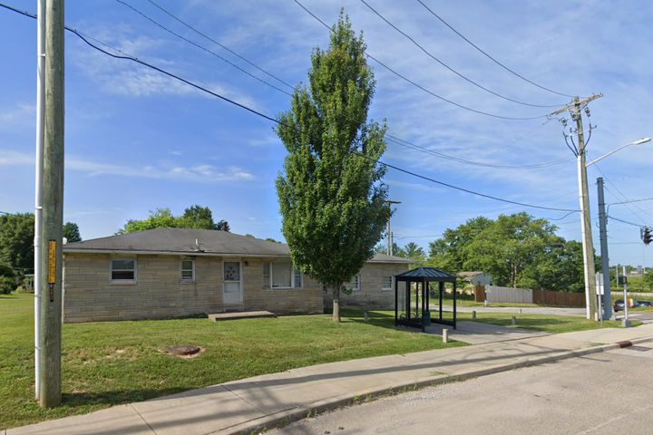
The parking spaces are meant to serve the Centerstone building located to the south of the parking spaces. The Centerstone facility offers addiction and psychiatric treatment, as well as counseling, crisis and urgent care services. The two Centerstone buildings—the other one is located at the corner of Rogers and 1st streets—are the only two in the plat area that are not slated for demolition as a part of the redevelopment plan.
Binder said, “A greenway, I think we would all agree, is intended to be a street that’s like kind of putting pedestrians and cyclists, non-automotive transit, first—or at least alongside. So I really question the presence of the angle parking on a greenway.” Binder continued, “I think it’s fine that Centerstone has parking. And if you look at the overhead views, they do have plenty of parking. They have a parking lot to the east to the south, and they have street parking on both of those sides of the block, too.”
Binder wrapped up his point about on-street angle parking by saying, “[Centerstone doesn’t] need reverse-angle parking also on this one part of the project that we’re calling a greenway. Let’s just get rid of it.” Binder later used the Zoom chat interface to point out that the nearby hospital parking garage, which will not be demolished as a part of the real estate deal, could be used by Centerstone patrons.
Responding to Binder’s point about on-street parking were Patrick Dierkes, city of Bloomington project engineer, and Mary Krupinski, with Kirkwood Design Studio, which is one of the consultants on the project.
Dierkes said the stand-alone parking lot on the southeast corner of the block was a part of the original master plan as parking for Centerstone. But that parking lot was removed from the master plan, which reduced Centerstone’s overall parking capacity, Dierkes said. He said during the master planning process, Centerstone’s parking needs were “a large topic of conversation.”
Dierkes said the engineering department changed the angle parking to reverse angle parking, to improve pedestrian safety along the greenway street.
Krupinski said the inclusion of on-street parking was a matter of navigating the new need for a pedestrian way and the existing condition of Centerstone, and the number of clients the facility receives on a daily basis. There’s a lot of daily parking needed for Centerstone clients visiting the facility, Krupinski said.
A second issue raised by Binder was the size of the lots in the plat.
The various sizes of the 16 lots are supposed to provide flexibility to developers. That was the message to plan commissioners from Matt Wallace, who’s leading the design team for Shrewsberry & Associates. Developers could purchase an entire lot or just a portion, Wallace said, which would allow planning staff to make lot-line adjustments and not force someone to re-plat the whole lot.
Binder said he was pleased to hear Wallace talk about the possibility of a developer purchasing a smaller amount of land, if they wanted to. But he expressed some skepticism: “I just kind of question though, how much that’s really going to happen.” Binder wondered if it were more likely that one big developer would want to buy the whole block. Binder said if the aim is to encourage smaller neighborhood-scale development, the plat should include smaller lots to begin with.
Dierkes responded by pointing to the zoning for the area. Zoning districts include minimum lot sizes. For the area of the plat there are two zoning districts—MM (mixed-use medium scale) and MN (mixed-use neighborhood scale). The minimum lot size for both zoning districts is 5,000 square feet. The lots in the southeast corner of the plat are a bit larger than that. One is 0.156 acres or about 6,800 square feet. And several others are 0.174 acres, which is about 7,500 square feet.
Plan commissioner Jillian Kinzie said she supports the encouragement provided by the plat for smaller-scale development. “If we can communicate that, and actually get some small scale development, that would be wonderful,” Kinzie said.
Another point Kinzie supported is the planned approach to stormwater retention. All of the required stormwater retention is supposed to be achieved on parcels where the greenway is to be built. Shrewsbury’s Wallace said there would be underground retention tanks and a wetland feature, which would both store stormwater. Future developers will not have to create their own stormwater systems, Wallace said.


Comments ()