Bloomington OKs $209K contract to study Rogers Street corridor, part of safe streets effort
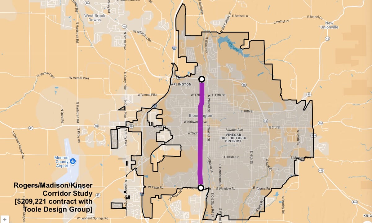
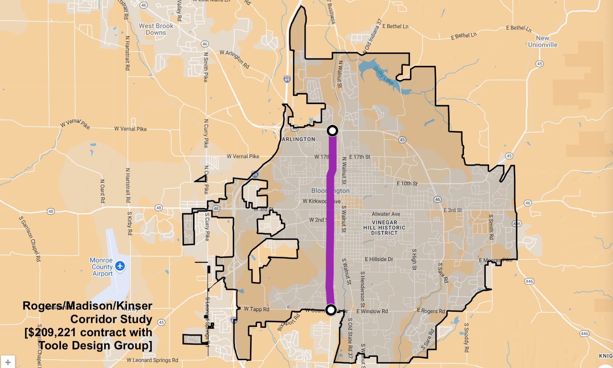
Now set for closer study is the Rogers Street corridor, stretching 4.5-miles from Bloomington’s southern boundary to the SR 45/46 bypass. Approved on Tuesday night by Bloomington’s board of public works was a consulting contract with Toole Design Group worth $209,221.
Now set for closer study, in connection with Bloomington’s effort to eliminate fatal and serious injury crashes, is the Rogers Street corridor, stretching 4.5-miles from Bloomington’s southern boundary to the SR 45/46 bypass.
Approved on Tuesday night by Bloomington’s board of public works was a consulting contract with Toole Design Group worth $209,221.
On its southern end the corridor starts on Rogers Street at Country Club Drive and eventually heads across the bridge over the railroad tracks, where the street name becomes Madison, then across 17th Street when it becomes Kinser Pike, continuing on to the bypass.
The corridor study is scheduled to take place over about 10 months, from July 2025 through April 2026, and is supposed to include public engagement and outreach, data collection and analysis of existing conditions, and the development and evaluation of design alternatives which lead to a “workshop week” with community input. The work by Toole is supposed to result in the publication of a corridor study.
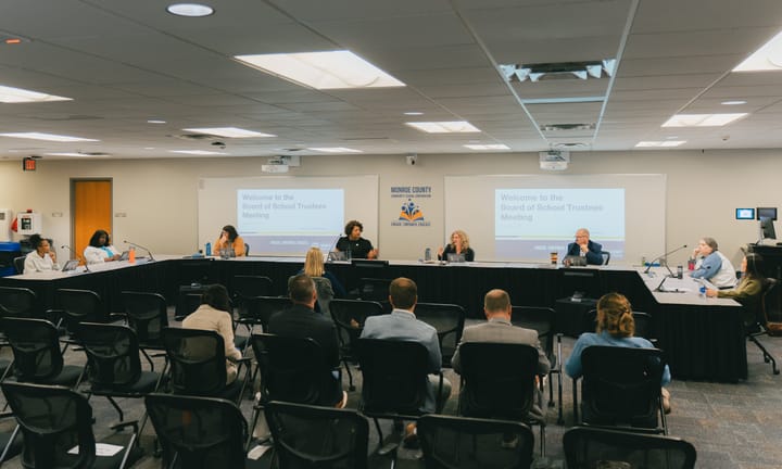
Presenting the meeting agenda item to the board of public works on Tuesday night was Bloomington’s bicycle and pedestrian coordinator, Hank Duncan.
The Rogers Street corridor study is connected to the city’s effort to make traffic infrastructure improvements to improve safety on the city’s streets. Responding to an emailed question from The B Square, Duncan described how the corridor study fits with the city’s recent application for federal grant funding through the Safe Streets For All (SS4A) funding.
Duncan wrote: “Essentially, the study, funded locally, will help the City develop a vision of the corridor, which will give us the exact ways of how we can improve the infrastructure on the corridor using the SS4A grant funds (assuming the City receives this grant).”
Duncan added, “We specifically included this corridor in the SS4A grant application because of the serendipitous timing and the fact that USDOT may look favorably on the fact that we are doing extensive outreach prior to constructing any improvements.”
Bloomington has adopted a goal of zero traffic deaths by 2039.
At Tuesday’s meeting board president Kyla Cox Decard alluded to the concerns she had expressed previously, in 2022, when Toole Design had been awarded the contract for College and Walnut corridor study, given the firm’s role in developing the city’s transportation plan, which had initially recommended reverting the one-way pair of street to two two-way streets.
The College and Walnut corridor study is still pending.
Responding to a question from Cox Deckard, Duncan said on Tuesday that six firms submitted proposals in response to a Request for Information (RFI) that was distributed through several channels, including the American Planning Association (APA) and direct outreach to specific firms. The evaluation criteria included the project manager’s qualifications, project team and structure, relevant experience, values, project approach, and other factors, Duncan said.
Each team member scored the proposals independently before meeting to discuss and finalize the selection. Duncan said that Toole Design Group was chosen in part because of its ability to perform all work in-house, reducing the need for subcontractors. He also noted that Toole’s relevant project experience and prior working relationship with the city were significant factors in their selection. Duncan said the other firms were qualified, but Toole was determined to be the best fit for the project.
Included in the board’s meeting information packet for Tuesday was a formal statement of disclosure about the connection between one of Toole’s employees, Beth Rosenbarger, and Bloomington city councilmember Matt Flaherty, who is Rosenbarger’s husband.
Cox Deckard pointed to the strong relationship between the College and Walnut corridor and the Rogers Street corridor, saying it’s hard to think about one corridor without also thinking of the other. She said, “I think it gives an opportunity for Toole to be creative in how they look at all of the corridor studies and how they’re engaged, and how we can creatively adapt the needs that we have, considering we do have those two strong corridors.”
Cox Deckard also recalled from her youth the old Rogers Street bridge over the railroad tracks near 11th Street: “You know, 40 years ago, this particular corridor looked quite different. I still remember as a kid going over the bumpy wooden bridge on Madison over the hill.”
She added, “So I’m looking forward to what Toole might be able to envision, having had the depth of experience that they’ve had up to this point.”
The “bumpy wooden bridge” that Cox Deckard mentioned was replaced in the late 1980s, at the same time Rogers Street was re-aligned to curve into Madison Street.
In a 1988 H-T article (“Rogers bridge replacement work to begin later this year”
reporter Steven Higgs described the bridge like this:
Approaching from the north, it looks like a rickety old bridge. From the south, it looks downright ominous.
The bridge rises from the road surface up a short, but steep ascent that, at its crest, looks like a small drawbridge in the up position. Visibility is nearly blocked from the angle of the incline.
And when driving from one side to the other, roughly 25 feet above the railroad tracks below, some may hold their breaths until they reach the other side.
The difference in the current road alignment for Rogers Street at the railroad tracks near 11th street can be seen in the historical aerial imagery available through Monroe County’s GIS website.
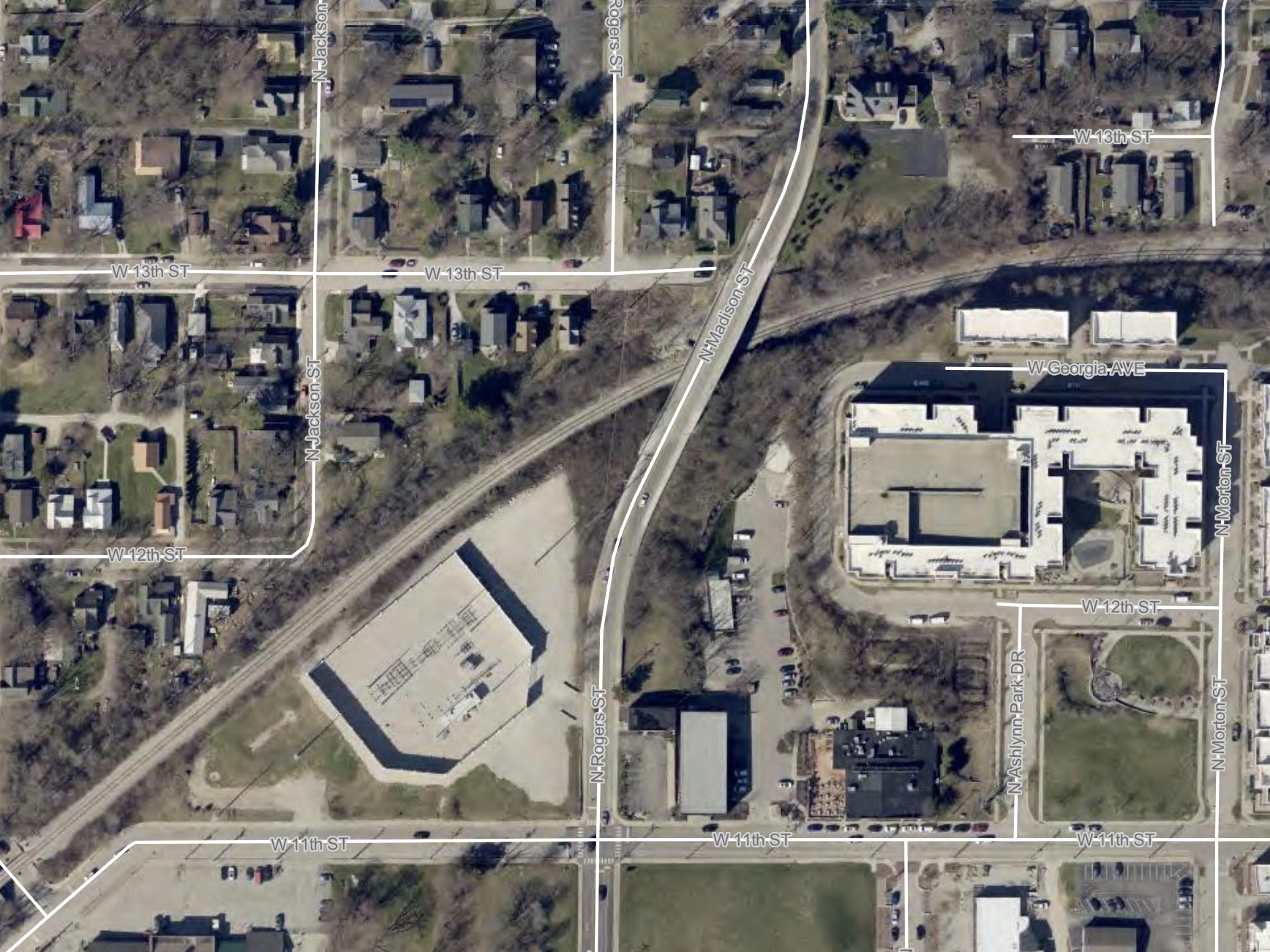
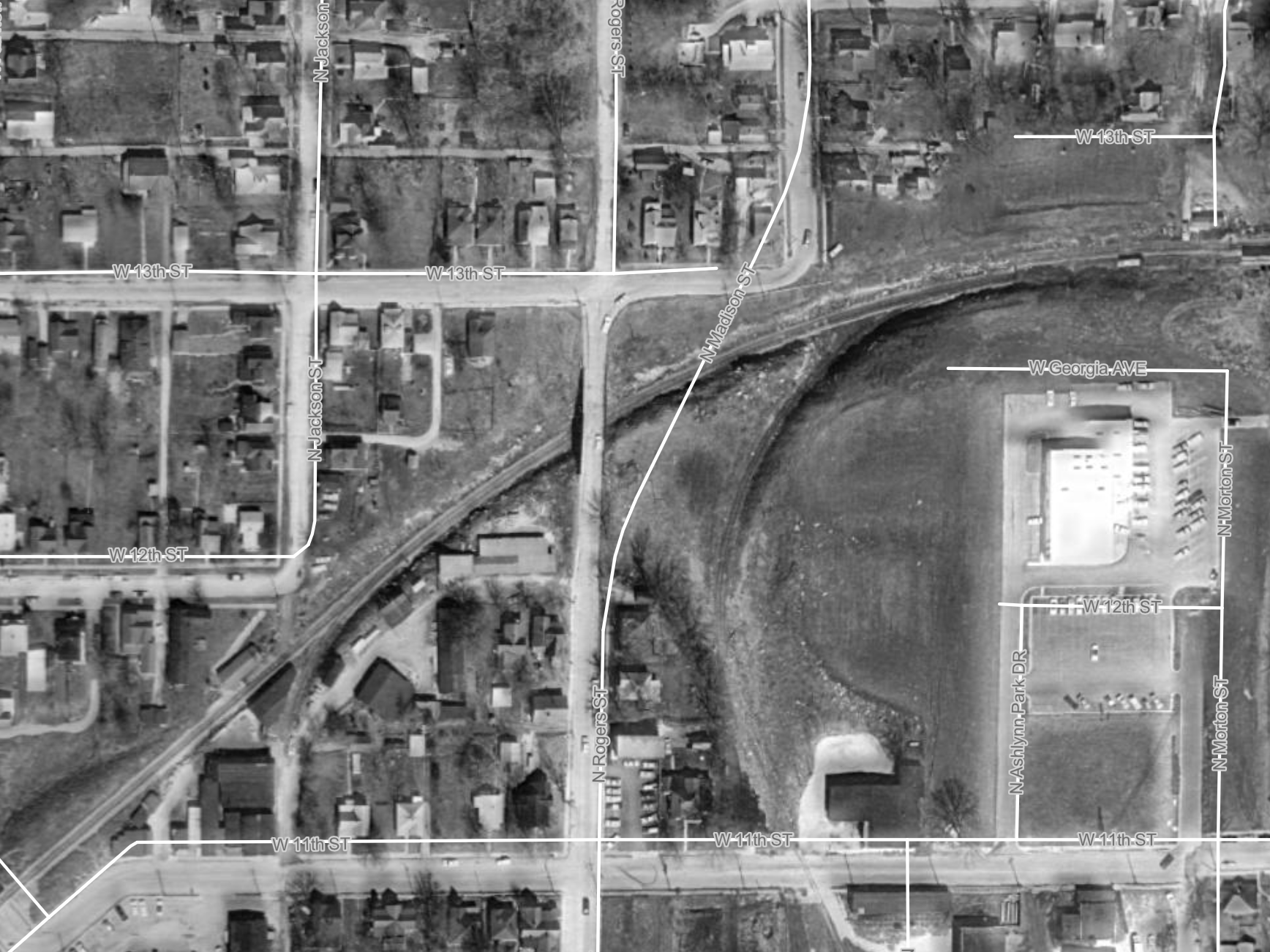
Rogers Street at the railroad tracks. Left: 2024 aerial imagery. Right: 1967 aerial imagery. Source: Monroe County GIS.
Comments ()