Tornado Watch for Monroe, other Hoosier counties issued for Wednesday, April 2, 2025 through 10 p.m.
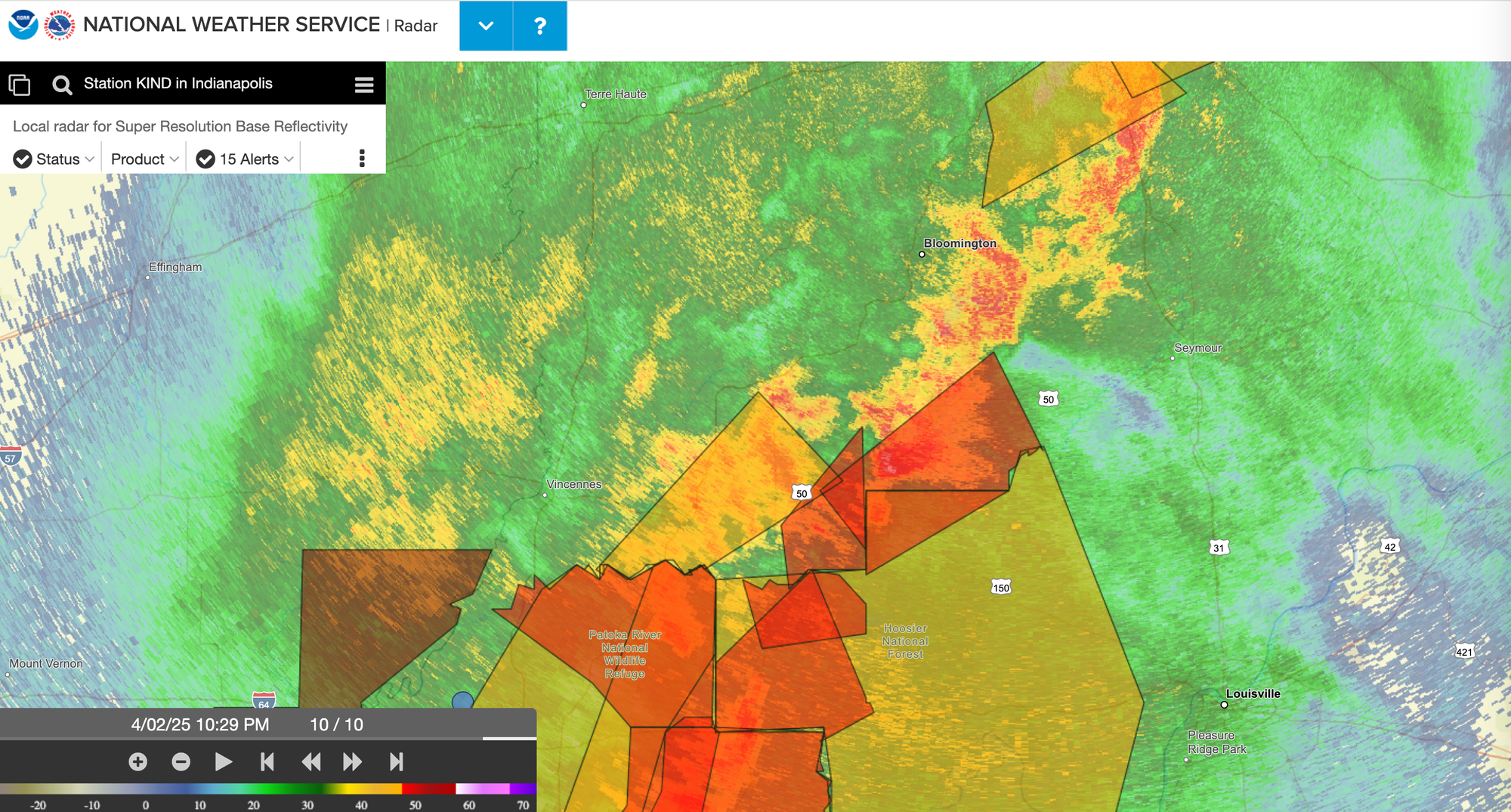
1:01 a.m. Monroe County remains under a flash flood warning until 2 a.m. This is the final update from The B Square. You can monitor the outlook and the warnings from the NWS radar page.
10:10 p.m. According to first responder scanner traffic, a tornado warning has been issued for southeastern Monroe County until 11:30 p.m.
10:08 p.m. Sirens are sounding in downtown Bloomington. (It's not yet apparent from NWS sources that there is a tornado warning that has been issued.)
10:57 p.m. The NWS has issued another severe thunderstorm warning for southern Monroe County until 11:30 p.m.
10:52 p.m. The NWS has issued a flash flood warning until 2 a.m. for an area that includes most of Monroe County. According to the warning, the general kind of impacted areas are "small creeks and streams, urban areas, highways, streets and underpasses as well as other poor drainage and low-lying areas." Places named in the warning as likely to see flash floods are: Bloomington, Greenwood, Franklin, Martinsville, Mooresville, Spencer, Nashville, Ellettsville, New Whiteland, Whiteland, Bargersville, Brooklyn, Trafalgar, Monrovia, Morgantown, Gosport, Paragon, Stinesville, Bethany and Mahalasville.
10:33 p.m. Tornado warnings are starting to come in for counties southwest of Bloomington. It's the weather that is headed for Bloomington next.
10:23 p.m. An excursion down Kirkwood Avenue to inspect surface stormwater flow reveals that, for now at least, the street drains are gulping down much of the flow, but not all of it. Still, at Kirkwood Avenue and Dunn Street there's no massive street flooding like there was in 2021.
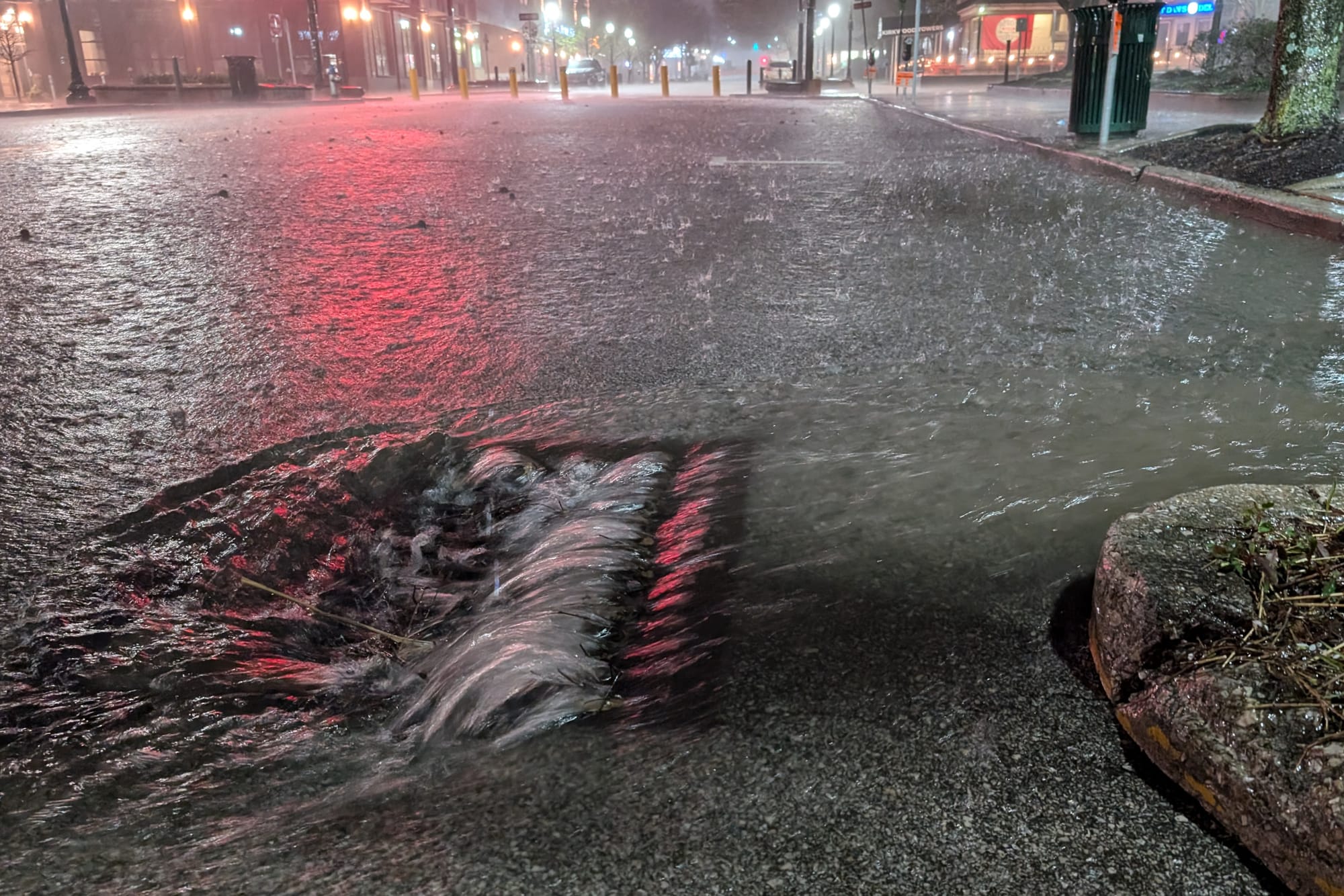
9:54 p.m. It's now started to rain hard in downtown Bloomington.
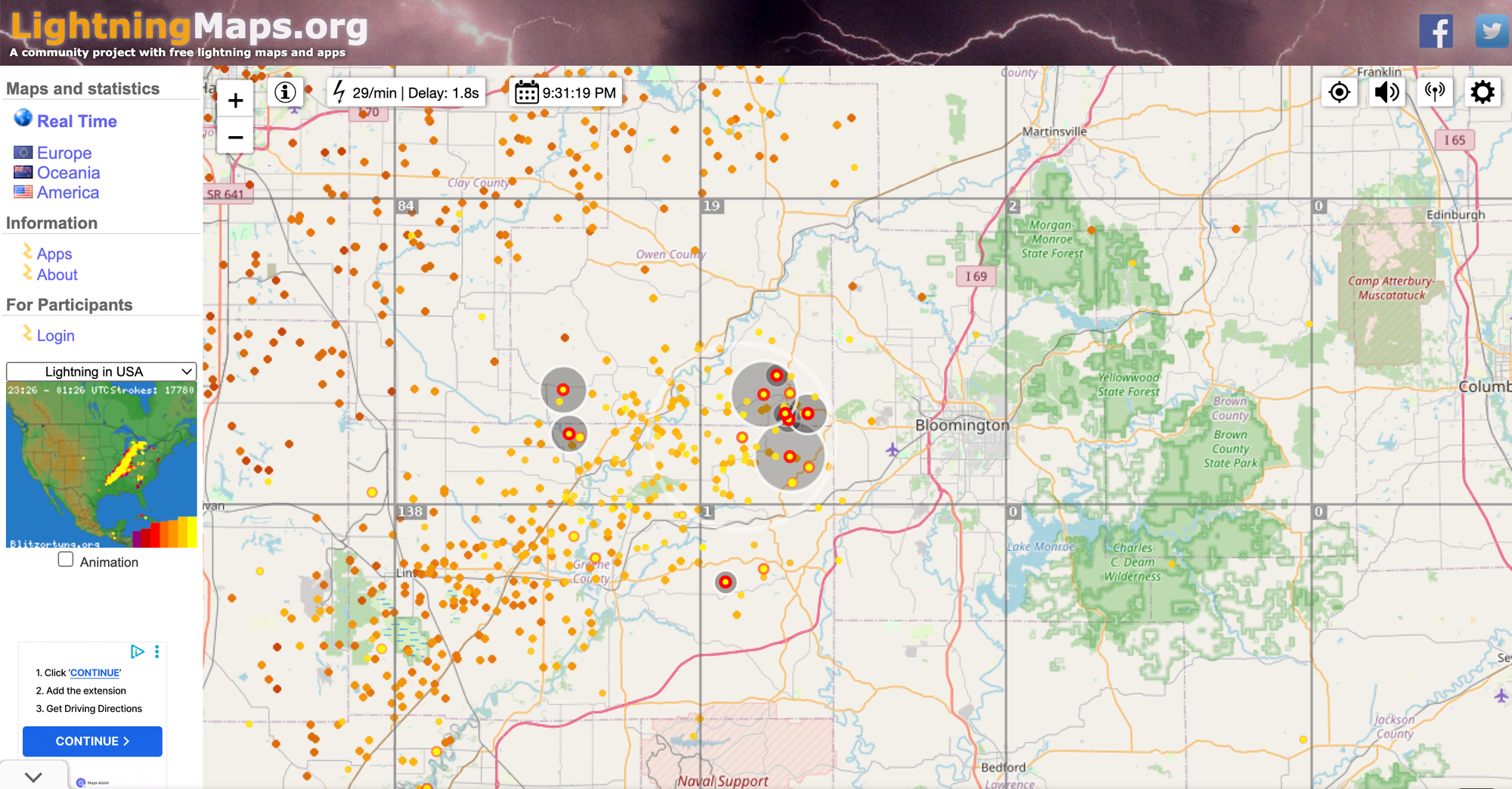
9:31 p.m. LightningMaps.org shows an active cluster of lightning strikes in Greene County. As the cluster moves northeast, it looks like northwest Bloomington and Ellettsville are in a direct path. Thunder clearly audible in downtown Bloomington.
8:46 p.m. Monroe County alert system sends out the severe thunderstorm warning that includes Monroe County.
8:43 p.m. NWS issues a severe thunderstorm warning for Monroe County lasting until 9:30 p.m. According to the the warning, at 8:43 p.m. "severe thunderstorms were located along a line extending from 8 miles east of Brazil to 14 miles north of Linton to 7 miles southeast of Russellville, moving east at 70 mph." The warning cautions that 70 mph wind gusts and half-dollar size hail could come with the storm. The warning was based on radar images. The warning says that "hail damage to vehicles is expected." The warning also says "considerable tree damage" is expected as well. The warning describes as "likely" the potential wind damage to mobile homes, roofs, and outbuildings.
8:36 p.m. Bloomington has so far escaped the worst of the storm as it moves from southwest to northeast, sitting just at the edge of the line of severe weather, according to NWS radar. But based on the size of the angry red patches around Evansville, Bloomington probably will not make it through the night unscathed.
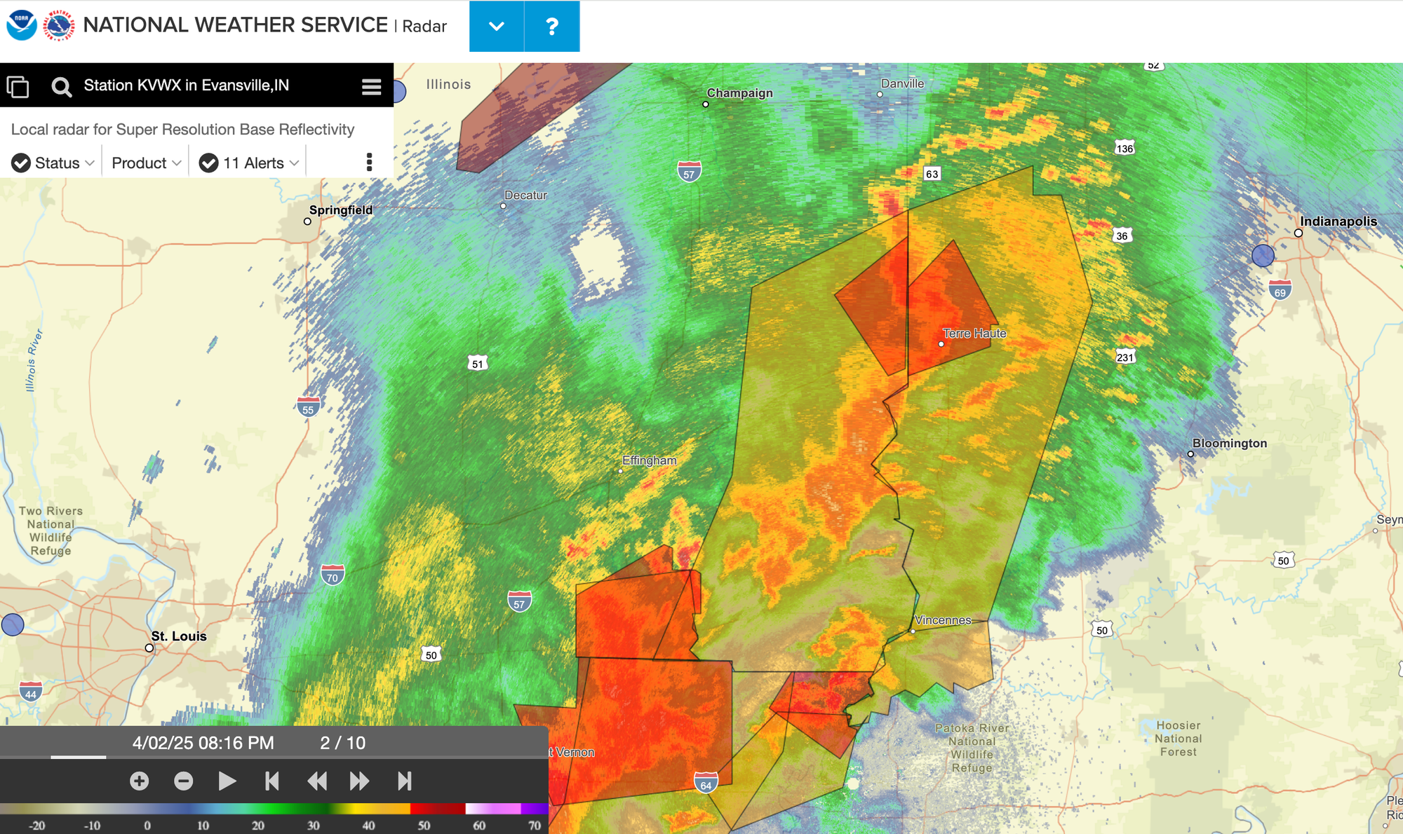
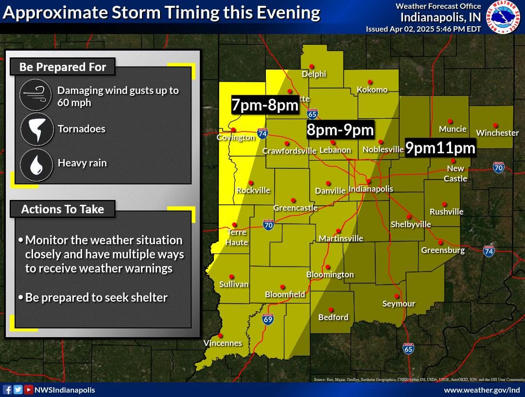
5:46 p.m. The National Weather Service has issued a tornado watch for 28 Indiana counties, including Monroe County, lasting until 11 p.m. Wednesday (April 2).
The issuance of a watch was not a surprise, as the system that is moving across the Midwest was forecast the day before. By mid-afternoon, the forecasted gusts of wind up to 45 mph had started to buffet the area, with a few reports of wires and trees down, according to first responder scanner traffic.
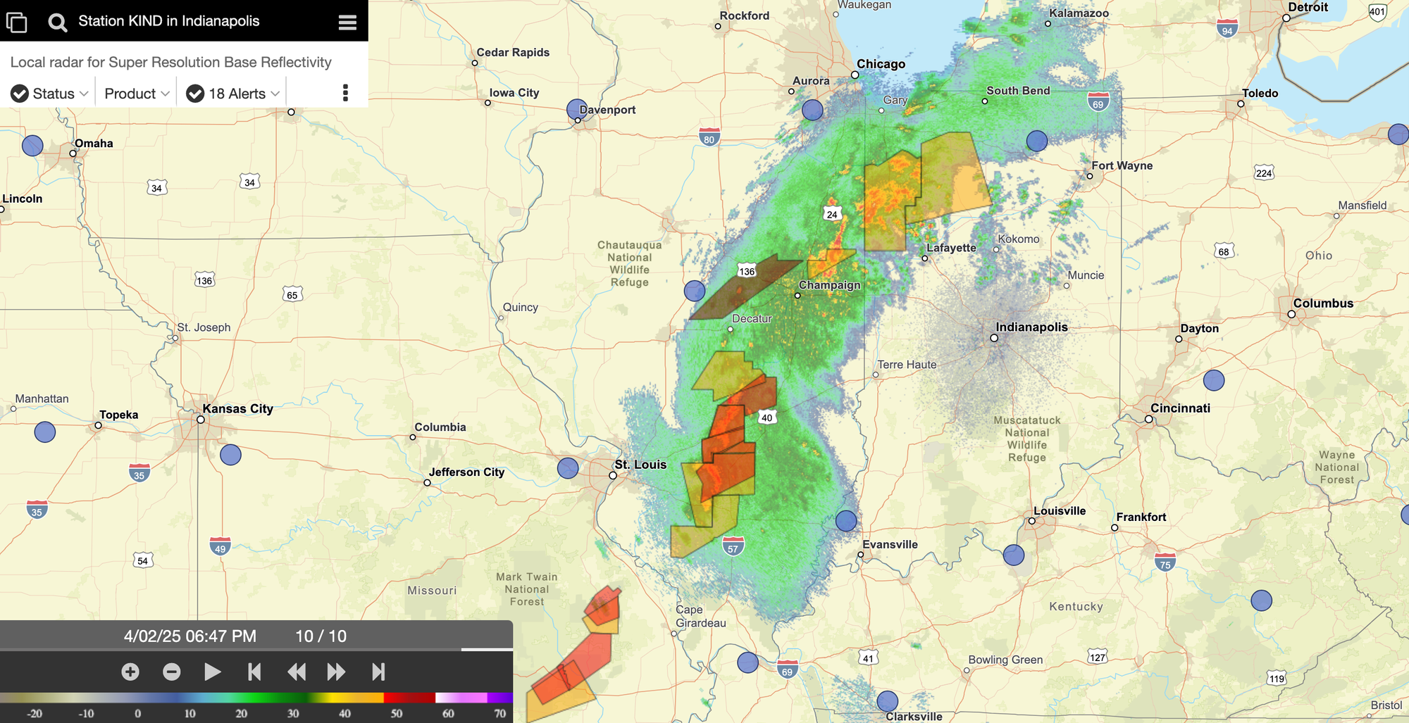
As of 6:50 p.m. NWS radar showed the line of the most severe weather just west of the Illinois-Indiana border headed for southern Indiana.



Comments ()