
Water levels at Lake Monroe high, but not record-setting, drier weather in forecast
Lake Monroe remained nearly 13 feet above its normal level on May 27, ranking among the highest late-May levels on record. Flooding has closed beaches, campsites, and roads but the lake remains open for boating as dam releases stay limited to protect downstream communities.
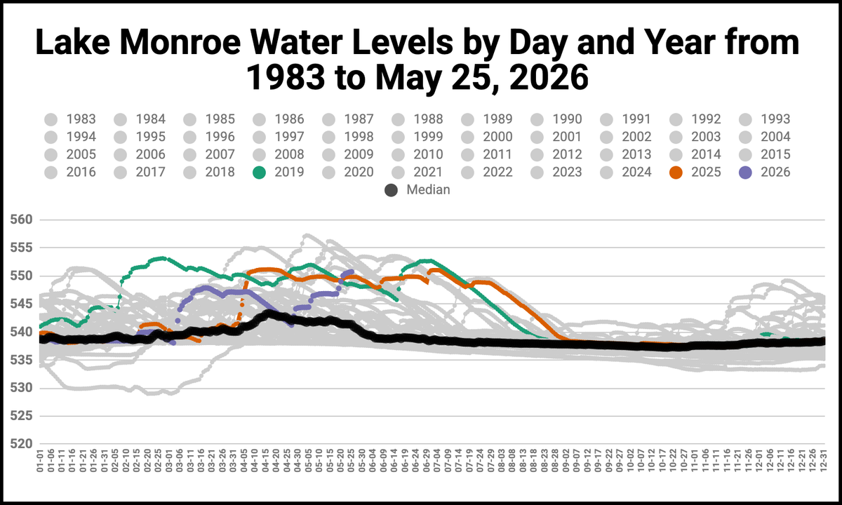
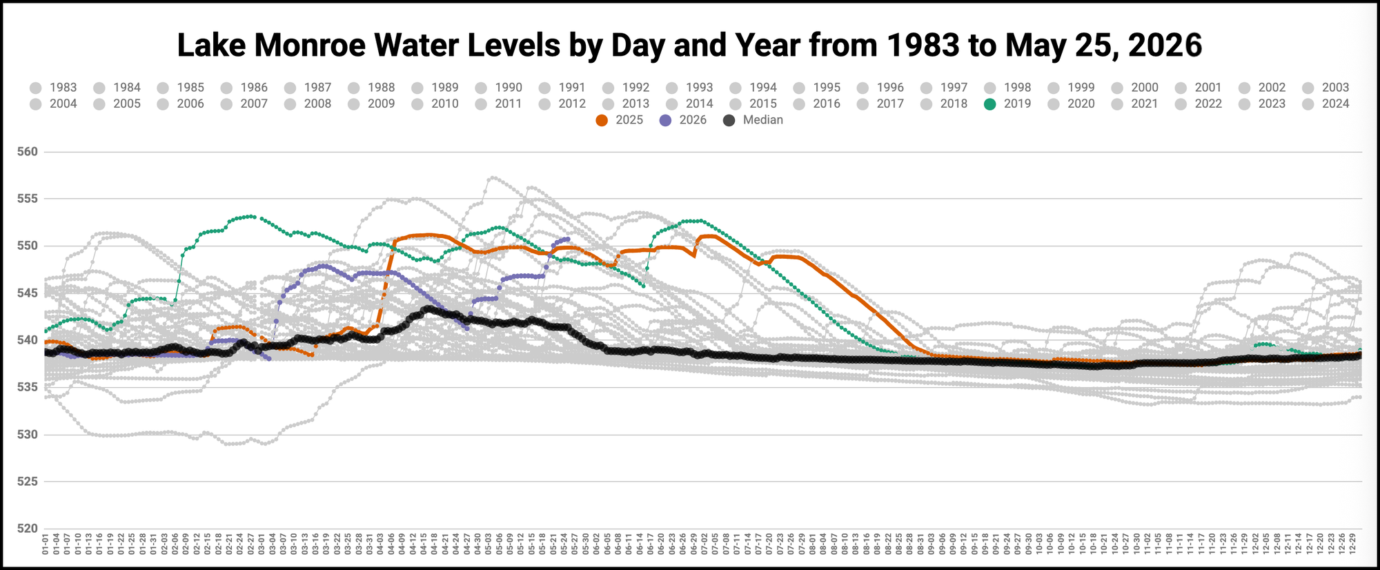
Water levels at Lake Monroe remain well above normal on Wednesday (May 27), but the official word from Indiana Department of Natural Resources is that the lake remains open and safe for boating.
One caution from the DNR is that flood conditions can carry additional debris into the reservoir. The DNR notes that the high water has expanded access to backwater areas for paddlers and other non-motorized boaters.
High water continues to disrupt normal operations at several recreation areas around the lake, but there are standard contingencies in place, like boat ramps specifically designated for high-water conditions. Swimming beaches at Paynetown and Fairfax state recreation areas are closed, and some roads, docks, trails, campsites, and marina facilities are inaccessible due to flooding. The Pine Grove recreation areas is completely closed.
One of the key functions of the lake is to serve as flood control for areas downstream from the dam, at Harrodsburg. In the terminology of the U.S. Army Corps of Engineers, which manages the Monroe Lake reservoir, the target level of the lake is called the “normal pool.” The current level is 550.80 above sea level. Right now the lake level is around 550.8 feet above sea level, or 12.8 feet above the normal pool.
Based on records since 1983, the average lake level starts to rise in late February and will stay above normal pool through mid-July. The current lake level is high, even for this time of year, but isn’t close to the absolute record, which was about 7 feet higher. That came in May 2011, when the water level hit 557.26 feet. Still, the level this week ranks fourth for the highest lake level at this time of year.
The water level will drop due to two basic factors: more water can be let through the spillway; and there’s not too much rain in the forecast for the next two weeks. But the rate of discharge can’t be increased just to get the water level in the lake down. By design, the lake level is supposed to be high during periods when more than a normal amount of rain fails, in order to protect downstream areas. A normal May sees 4.47 inches of rain. This year so far in May, 6.14 inches of rain have fallen.
During flooded conditions, the minimum discharge through the dam is 200 cubic feet per second (cfs), and can’t be set higher than that unless the downstream gauges on the White River at three locations read lower than minor flood stage. The three key locations are Bedford (20 feet minor flood stage), Shoals (20 feet minor flood stage) and Petersburg (16 feet minor flood stage). The US Geological Survey makes available online a real-time three-way plot of those gauges.
The historical data on lake levels, which includes discharge rates, can be monitored online. The current recorded figure for the discharge rate is 242 cfs, which is higher than the 200 cfs at which its set, because of the hydrostatic pressure from the overfull lake.
Photos: High water at Lake Monroe (May 25, 2026)


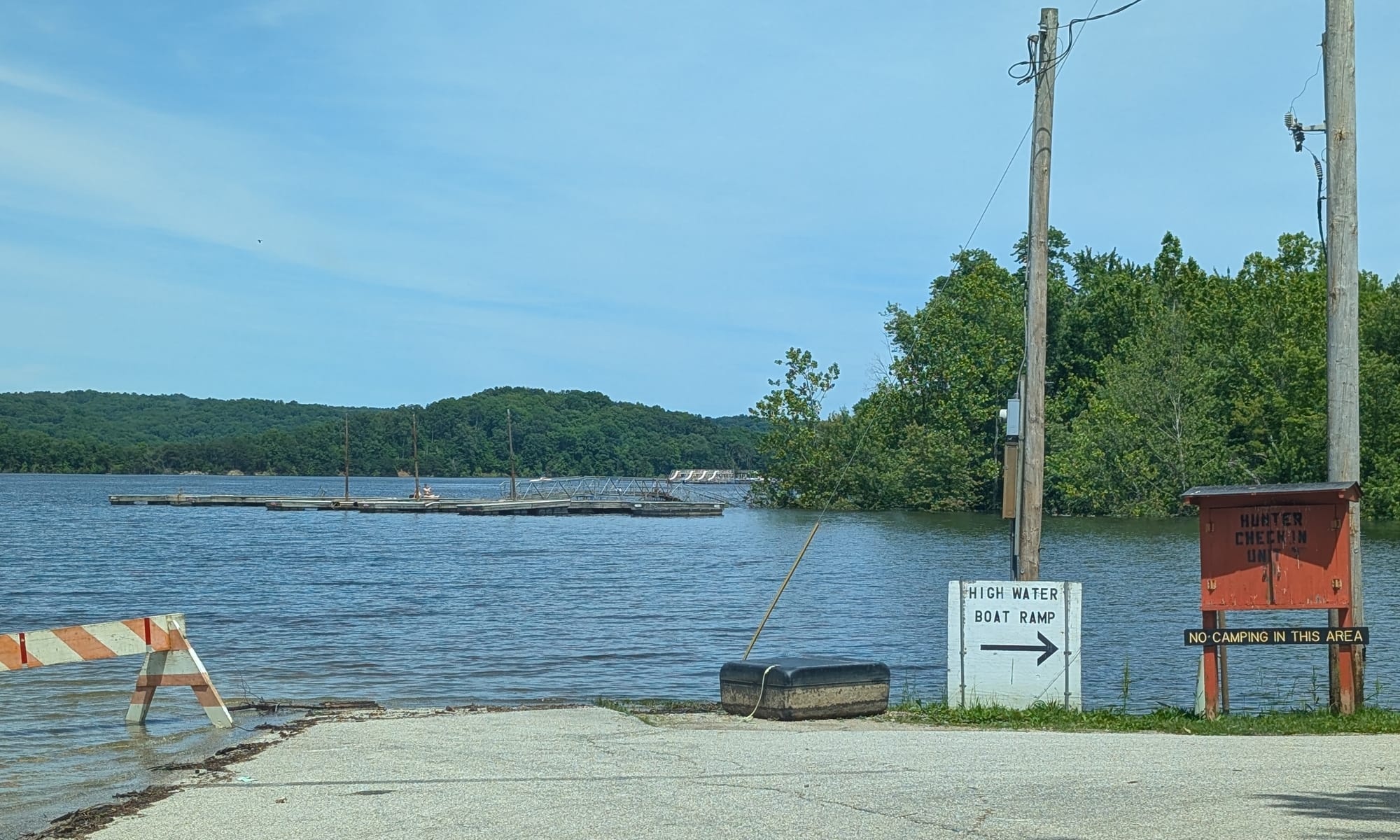
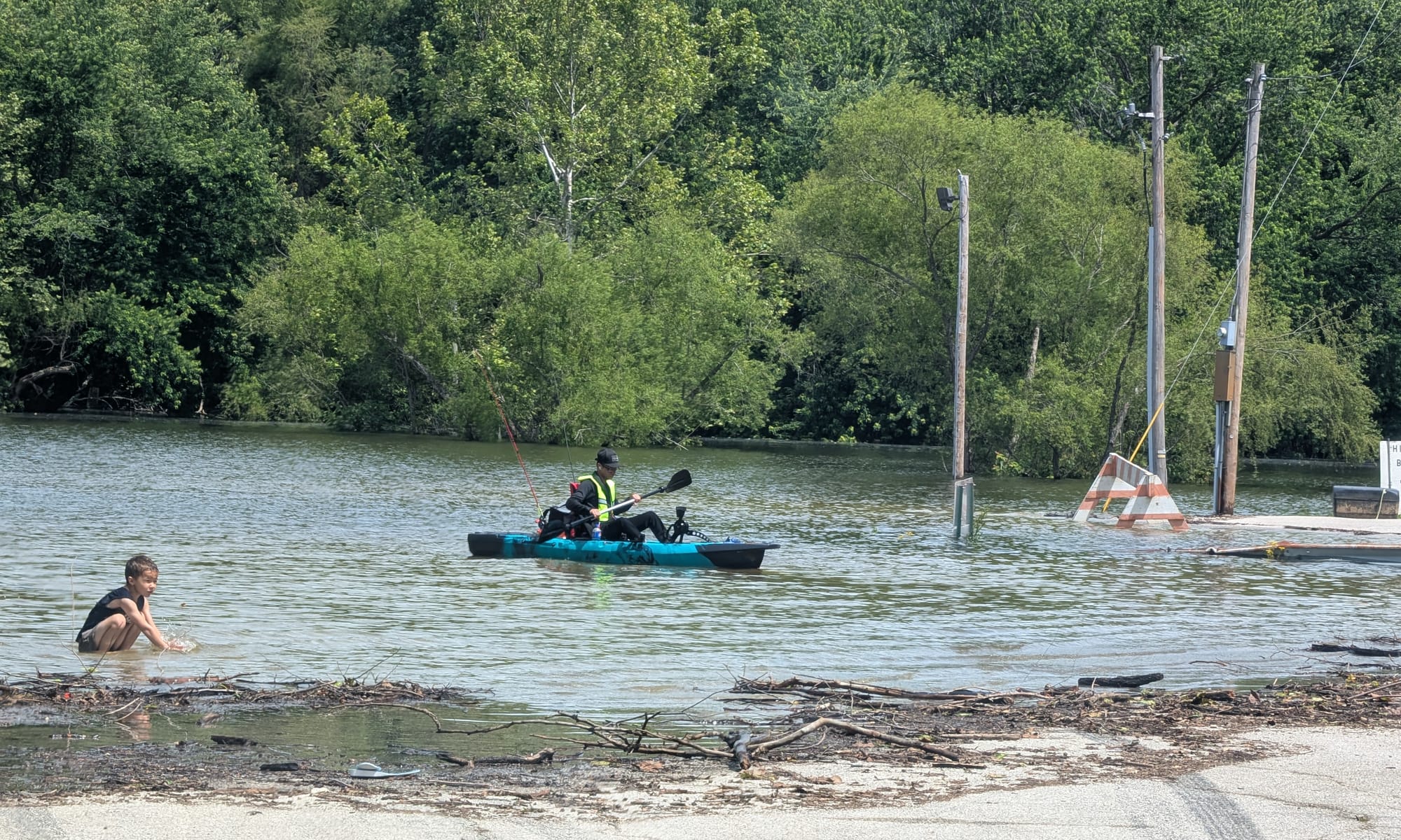


Cutright SRA (Dave Askins, May 25, 2026)





Comments ()