Column: Hawk’s nest on courthouse grounds squares up with Bloomington zoning, new online maps prove

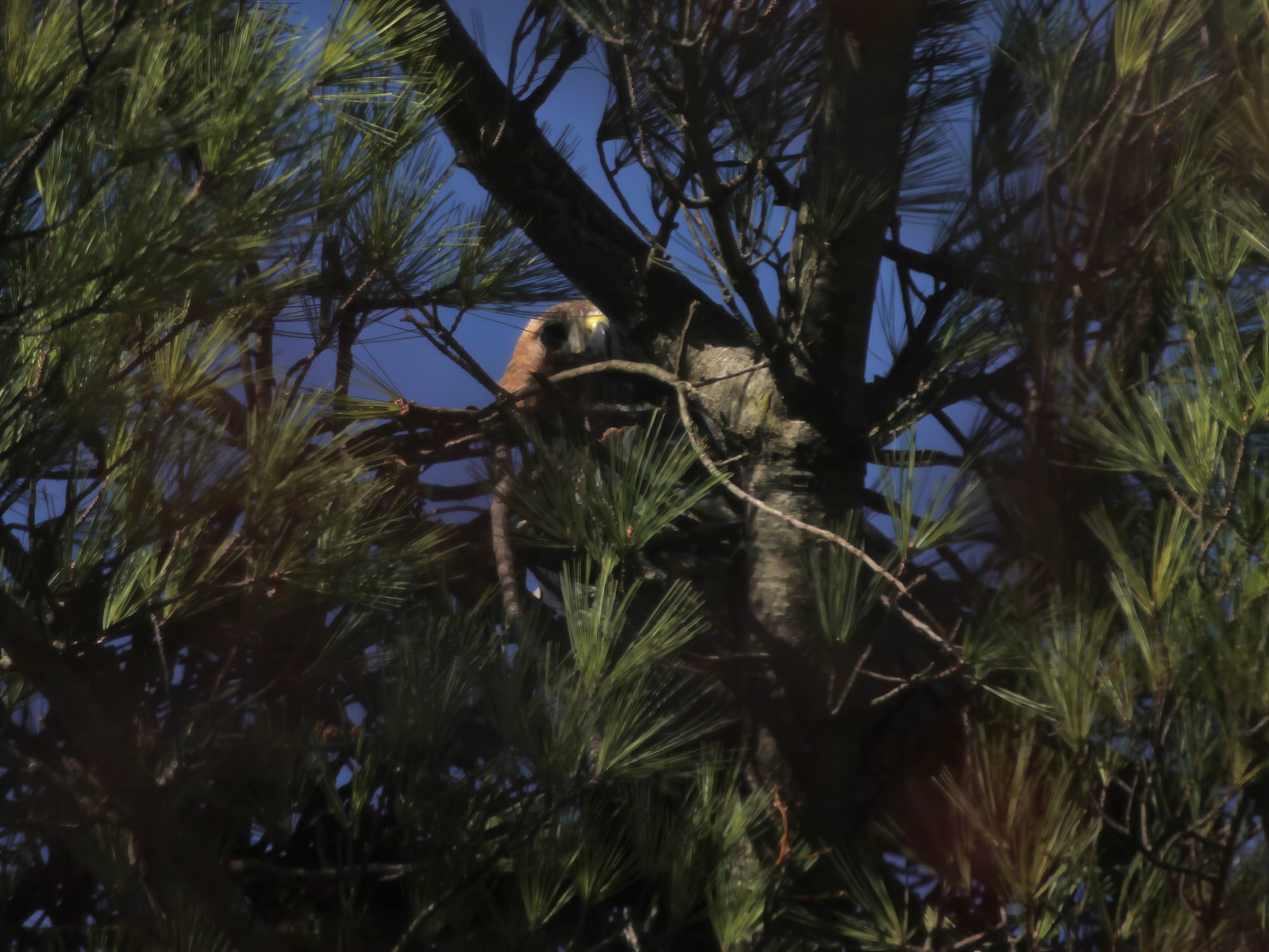


A pair of red-tailed hawks started the spring season renovating last year’s nest above Bryan Hall on Indiana University’s campus.
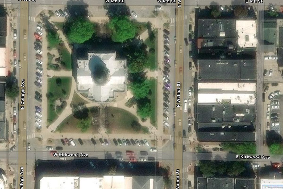
But some readers might have noticed that the birds seem to have shifted their focus to the grounds of the Monroe County courthouse in downtown Bloomington.
That means the raptors will no longer be in the running for any sustainability awards, for what could have been a spectacular reuse project. At least not this year.
The first question that most Bloomington residents will ask about any nest building activity will be: Is that kind of residential use even consistent with the zoning for this part of the city?
The city of Bloomington has now made that question a little bit easier to answer.
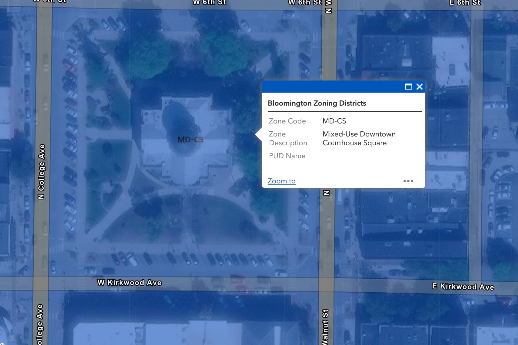
Last week the city unveiled what it’s calling the Bloomington GeoHub. Among the resources on the GeoHub is a handy dynamic map of all the city’s zoning districts. The dynamic zoning map itself is not new, but now it’s sitting in a place with lots of other geographic resources, which will probably make it easier to find.
Based on that zoning map, the block where the county courthouse stands is zoned as: Mixed-Use Downtown Courthouse Square Downtown Character Overlay (MD-CSO).
In the city’s unified development ordinance, the allowed use table for MD zoning districts does not include single-family detached dwellings. But it does include single-family attached dwellings—even if the asterisk next to the ‘P’ for “permitted” means that some use-specific standards apply.
So the question becomes: Should a hawk’s nest be analyzed as a detached single-family dwelling, which would not be allowed?
It’s worth noting that the nest is literally attached to something, namely a tree.
And it is well known that in the embrace of its branches, a tree nurtures a whole community of bugs and other critters, never mind squirrels and chipmunks.
So it’s fair to say that a hawk’s nest is not a detached single-family dwelling unit, and could even be considered part of a multifamily dwelling unit, which is an allowed use for the MD zoning district. So it conforms with the zoning for the Monroe County courthouse grounds.
The Bloomington GeoHub is a good step forward for making geographic information available to residents.
Available on the GeoHub are maps of city council districts, proposed annexation areas, historic preservation areas, street conditions, sidewalk gaps, parks, parking, and climate resilience information, among other topics.
The city uses Esri software to publish the maps on the internet. For residents who would like to get access to the raw geographic data used by the maps, a good place to start are the REST services for Bloomington data: https://bloomington.in.gov/arcgis-server/rest/services/DataPortal/
A useful query for grabbing all the data in a particular layer is to set the query condition to “1=1”. A useful tool for overcoming limits on number of records to be downloaded is: https://geodatadownloader.com/
Photos: March 11–12, 2024 Monroe County courthouse grounds


Comments ()